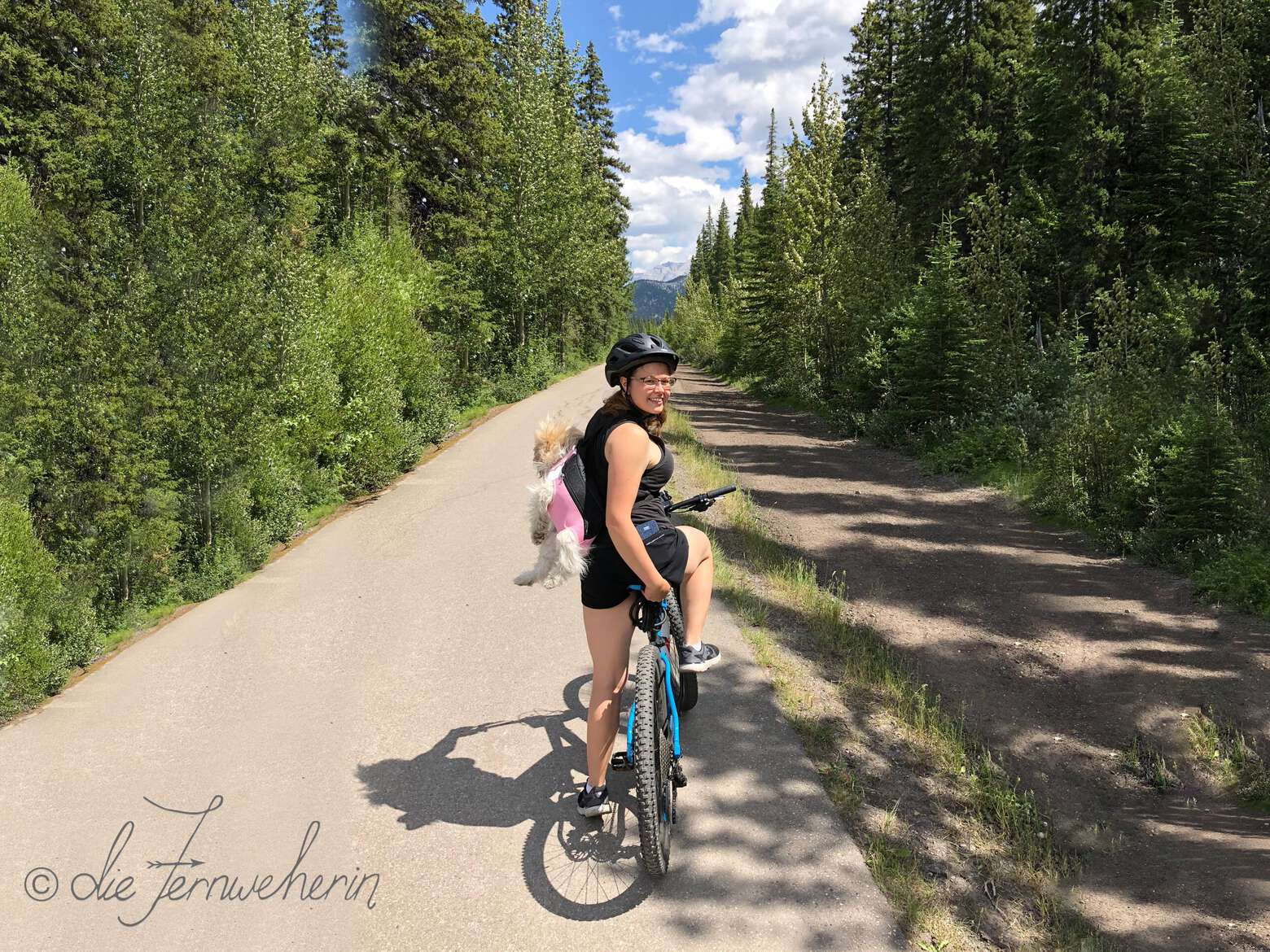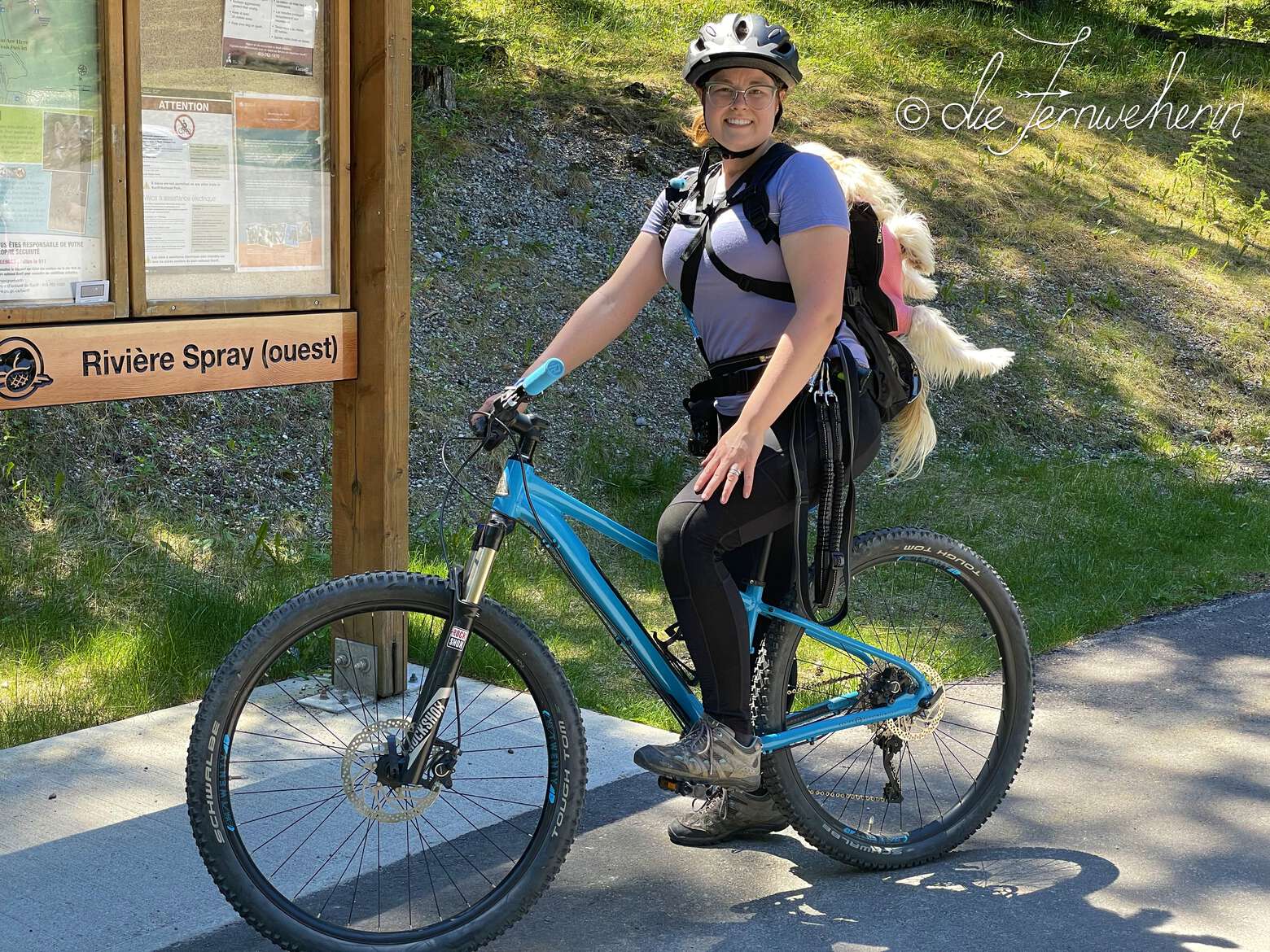
Boasting an area of 6500km2, Banff National Park is home to over 360km of mountain biking trails, and hundreds of kilometres of scenic roadways. And while you may think that the best rides must be found far from civilization, I’m here to tell you that you don’t even have to leave the town of Banff to get gorgeous panoramic mountain-top views, cruise alongside crystal clear—and yet stunningly blue—glacial meltwater, or do some sick singletrack shredding. So, whether you’re tired of commuting for an hour or more each day to access trails at tourist hotspots such as Lake Louise, or you don’t want to venture too far from those all-important creature comforts, or even if you just want to explore the town of Banff a little bit more, then this post is for you! There’s a trail for anyone and everyone in Banff, no matter your skill or fitness level, so read on to find out which one is right for you.
Contents
Before Heading Out
Staying safe
Remember that while exploring the outdoors in Banff, you are responsible for your own safety. Always be well-prepared when setting out (check out my Biking Safety Tips), and choose a trail that is suitable not only for you, but for your bike. For example, while you can certainly use a mountain bike on a roadway, it’s going to be more difficult than if you were riding a road bike; on the other hand, it is unsafe to attempt a mountain biking trail when riding a road bike. If you are biking as a family or group of friends, make sure that you choose a trail suitable for the least experienced/fit member of your group. If biking isn’t your forté, I have a great post about the 17 Fantastic Hiking Trails in the Town of Banff that you can read instead.
Trail ratings
To help you choose an appropriate trail, I have provided stats, information on common usage, and a description of each one. All figures listed assume a full roundtrip from the trailhead. As I used a variety of sources to obtain the data, I have provided my calculations as rounded numbers (and yes, I use the metric system; if you’re more familiar with imperial measurements, i.e. miles & feet, please use a conversion calculator such as this one). Elevation gain is provided as a “gross” number (the actual number of metres that you have to ascend, without subtracting any elevation losses). And, last but not least, the difficulty of each trail is measured using the following seven-point scale:
difficulty | characteristics |
|---|---|
novice | suitable for beginner riders with no experience other than how to ride a bike usually accessible with bike trailers (chariots) short (<10km) mostly flat path is wide & paved |
elementary | suitable for beginner riders with little experience & no technical skills may be accessible with bike trailers (chariots) fairly short (<20km) mostly flat; some gentle elevation gain/loss path is wide; may be paved or hard-packed; no rocks/roots present |
basic | suitable for beginner riders with some experience, a few technical skills, and a rudimentary level of fitness usually not accessible with bike trailers (chariots) fairly short (<20km) rolling elevation gain/loss path is fairly wide; usually unpaved, but generally firm; some small rocks/roots are present |
intermediate | suitable for intermediate riders with moderate experience, technical skills, and level of fitness medium in length mostly rolling elevation gain/loss; some short steeper sections or longer gradual climbs path is beginning to narrow; may be somewhat loose (ex. gravel/sand/mud); small roots/rocks may be present throughout; corners are beginning to tighten optional technical trail features may be present |
hard | suitable for intermediate riders with additional experience, more technical skills, and a higher level of fitness variable length (may be short or long depending on other factors) few flat sections; elevation gain/loss is often steep and/or fairly long path is somewhat narrow; may be loose; small to medium roots/rocks are typically present throughout; tighter corners present some moderate non-optional technical trail features may be present |
challenging | suitable for advanced riders with ample experience, technical skills, and level of fitness variable length (typically longer) few flat sections; elevation gain/loss is often major, with very steep and/or long ascending & descending sections path is usually narrow; may be loose; medium to large roots/rocks are typically present throughout; sharp corners present (some blind) moderate to difficult non-optional technical trail features are present |
expert | suitable for advanced riders with extensive experience, highly developed technical skills, and an excellent level of fitness variable length few to no flat sections; elevation gain/loss is very steep & variable path may be very narrow; may be very loose; large roots/rocks are typically present throughout; very sharp, blind corners are present advanced non-optional technical trail features are present |
Trails on die Fernweherin are assigned a grade based on their most difficult criterion. For example, a short paved path that has a steep hill would be graded as “intermediate”, even though the majority of the trail may fit into the “novice” category.
When reading the trail stats, an asterisk (✲) denotes that the information as written may be altered by the trail user (e.g., the overall distance may be shortened by choosing a different trailhead); typically, this will be described longhand in the trail’s description.
Trail etiquette
& rules of the road
<< contents // < trail ratings
other things to know >
It is important to note that almost all biking trails in Banff National Park are multi-use trails. This means that you may come across hikers, horse-riders, trail-runners, and more. As a biker, it is important to remember that you yield to all other traffic, so use caution when travelling around blind corners and downhill. If you need to pass someone else, be sure to use your bell and/or call out “on your left”. Always stay alert, pay attention to your surroundings, and be prepared to stop and move aside as needed.
When on the road, bikes are considered vehicles throughout Alberta. This means that you must follow all the same rules as if you were a car (stopping at red lights & stop signs, yielding to pedestrians, obeying the “right of way” principle when turning, etc.). If there is one, always travel on the bike path that parallels the road; if not, try to remain on the shoulder; and if you are in a group, bike in single file.
a note on eBikes
While battery power is undeniably a godsend when travelling uphill, figuring out where you can & cannot ride your eBike in Banff National Park can be quite the headache, especially since Parks Canada keeps changing the rules (they’ve changed at least once while I’ve been writing this post). However, it can be done, and for the most part the rules are actually becoming more welcoming of eBikes as they become more popular. So, to determine whether or not you can ride your eBike on a particular trail, the first thing you have to check is whether or not your eBike qualifies as a “pedal-assist” eBike by Parks Canada’s standards, because if it does then you have a far greater variety of trails to choose from. As of December 2021, most of the trails in this post allow the use of pedal-assist eBikes, and this is noted in the trail stats below. However, since things are changing frequently, always double-check the current rules with Parks Canada using the link above.
If your bike is fully electric—also referred to as a “throttle” eBike—then it is not permitted on the trails in Banff National Park (even the paved ones). Throttle eBikes are, however, permitted on public roadways. In this post, there are four routes that you can ride a throttle eBike on: Vermillion Lakes Road, Golf Course Drive, Tunnel Mountain Drive/Road, and Mountain Avenue.
Other helpful things to know
<< contents
storage
Need to take a break from pedalling? There are bike racks throughout Banff that you can use to lock up your ride while you explore the town on foot, or grab a bite to eat. Nervous about leaving your new bike out in the open? The town also operates a bike valet that provides free, securely fenced, and staffed bike storage. This service is accessible from downtown Banff, near the Banff Visitor Centre, and is available seven days a week during the summer (June to mid-September) from 10:30am to 6:30pm (18:30). If you’re wondering what the Banff townsite has to offer, check out my post 50+ Things to Do in the Town of Banff.
rentals
Didn’t bring your bike to Banff? You can still enjoy these trails! There are several retail outlets in Banff that offer bike rentals of all varieties. Our personal favourite rental establishment is Snowtips/Bactrax. The staff are friendly and knowledgable, their equipment is top-notch, and their prices are competitive (for example, a full day’s use of a “trail” bike, suitable for both paved and unpaved routes, costs $44). This is #NotAnAd; we honestly just really like them.
<< contents
Easy Trails
- Bow river trail
- Vermillion lakes road
- Fenland trail
- Marsh trail
- Golf course drive
- Sundance trail
- Tunnel mountain campground trail
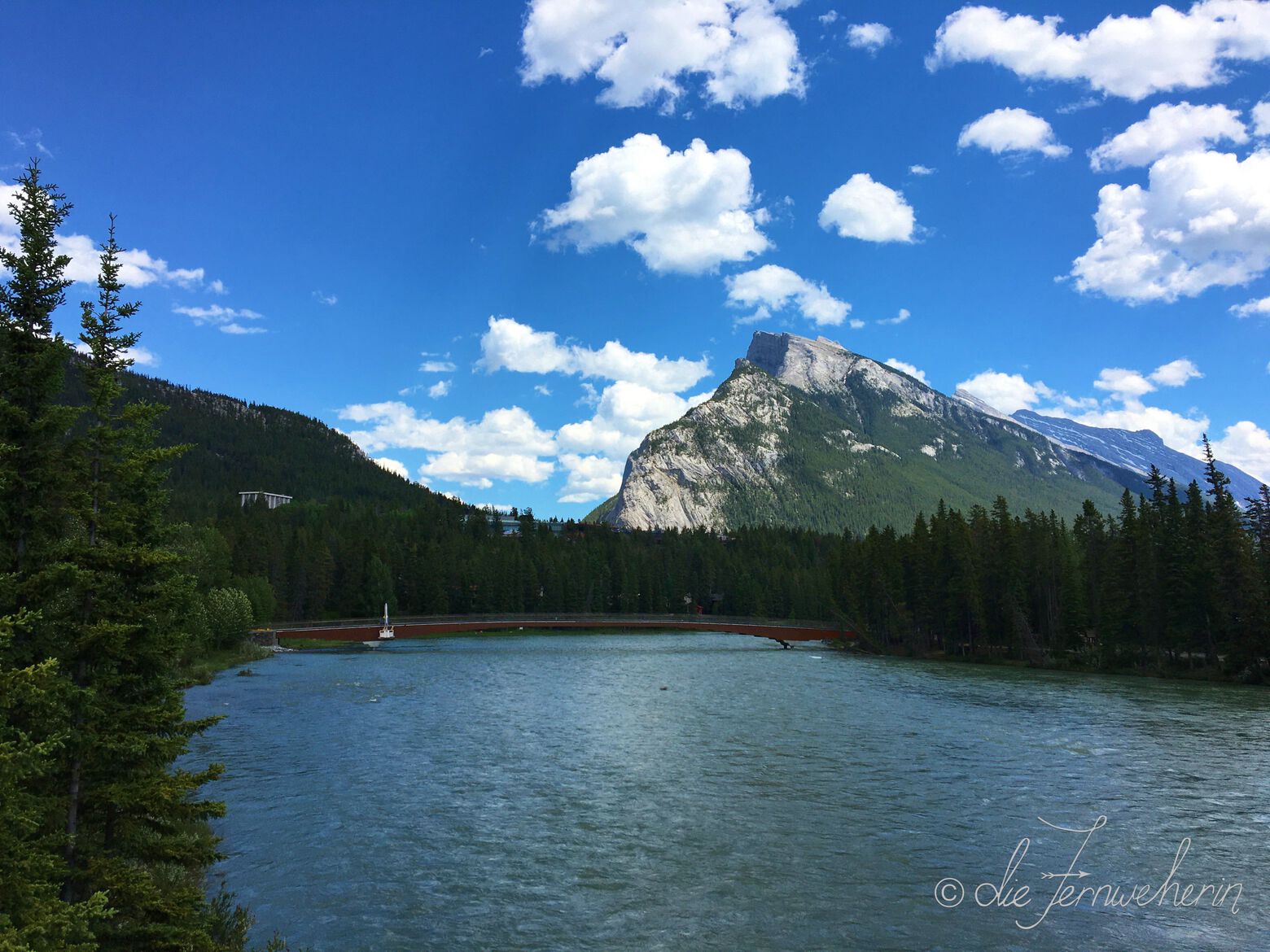
Bow river trail
trail stats
type |
out & back | rating |
7/10 |
length |
~4.5km ✲ | time |
~0.3h ✲ |
elevation |
minimal | difficulty |
novice |
trailhead |
Surprise Corner parking lot (at the intersection of Buffalo St & Tunnel Mtn Dr) | ||
use |
jogging/walking (year-round), road-biking (spring/summer/fall), fat-biking (winter) NO eBikes allowed |
||
map
description
This picturesque trail follows the northern shoreline of the Bow River as it flows past downtown Banff, stretching from the Surprise Corner viewpoint to Railway Avenue on the other end of town. It’s an easy ride with views of the river and surrounding mountains, as well as the castle-like Fairmont Banff Springs. This trail is very popular year-round, so be sure to watch for other users, including foot traffic. Many visitors complete only part of the trail, from Surprise Corner to downtown Banff (~3km / ~0.25h). You can connect to the Bow Falls Trail on the opposite side of the river using the pedestrian bridge (~4km / ~0.3h), but be aware that the stairs leading to the upper viewpoint are inaccessible to bikes, and closed in the winter due to ice. Lock your bike up here, or make a detour off the path onto Bow Falls Avenue and ride the road to the parking lot by the lower viewpoint. For those looking to spend more time in the saddle, this trail is a lovely extension to Golf Course Drive, Mountain Avenue, and/or Tunnel Mountain Drive/Road.
Vermillion lakes road
<< contents // < easy trails
trail stats
type |
out & back | rating |
6/10 |
length |
~9km | time |
~0.75h |
elevation |
~35m | difficulty |
elementary |
trailhead |
Fenland Trail parking lot (on Mt Norquay Rd between Vermillion Lakes Rd & the Banff sign) Fenlands Rec Centre parking lot (opposite side of the road) |
||
use |
driving/jogging/walking (year-round), road-biking (spring/summer/fall), fat-biking (winter) ALL eBikes allowed, including throttle eBikes |
||
map
description
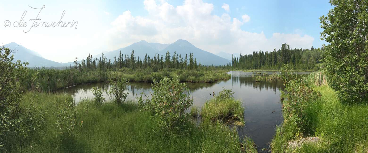
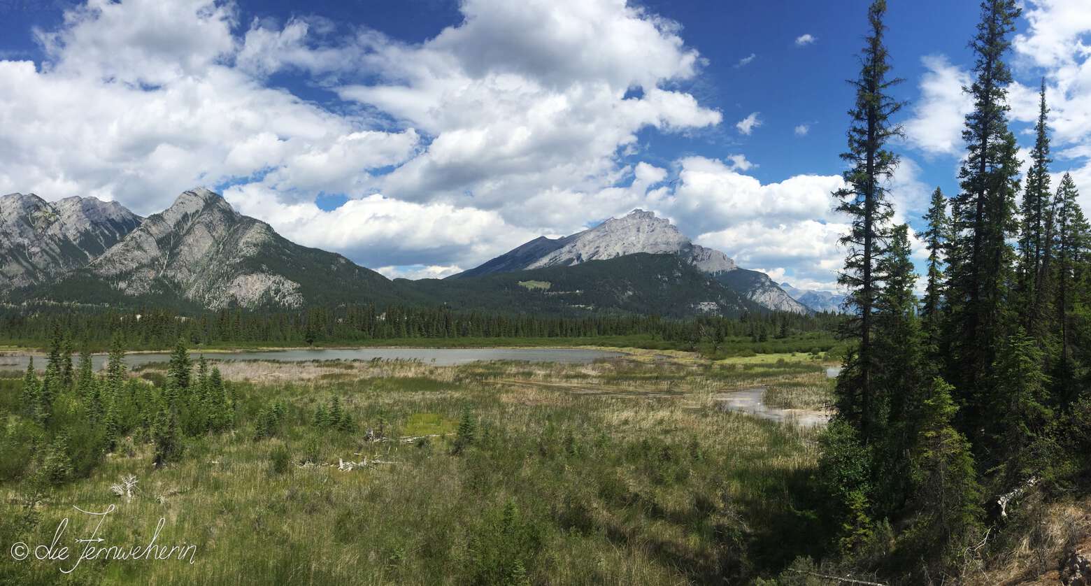
This roadway is somewhat unique in Banff, in that it was purposefully built to allow visitors to be able to drive or cycle past the three Vermillion Lakes. While these wetland lakes are not the pure blue of glacial melt, they are beautiful in their own right—especially if you visit during sunrise or sunset, when the red, pink, and orange hues of the sky are reflected in the water. This is also one of the best places in Banff to view the iconic Mount Rundle, and the area is frequented by elk, deer, and various birds. It’s a great place to start or end your day in quiet reflection, with several spots to stop, take a seat on a bench, and relax. This relatively short ride is a great way to get your legs warmed up for biking the much longer Bow Valley Parkway. Otherwise, if you’re not feeling up to a full day in the saddle, take a quick spin around the Fenland Trail loop.
Fenland trail
<< contents // < easy trails
trail stats
type |
loop | rating |
5/10 |
length |
~2km | time |
~0.2h |
elevation |
~55m | difficulty |
elementary |
trailhead |
Fenland Trail parking lot (on Mt Norquay Rd between Vermillion Lakes Rd & the Banff sign) | ||
use |
jogging/walking (year-round), mountain-biking (spring/summer/fall), fat-biking/snowshoeing/XC-skiing (winter) PEDAL-ASSIST eBikes allowed |
||
map
description
This is a short, easy ride through the wetlands on the edge of Banff’s town limits. While the views themselves aren’t spectacular, it’s a popular place to spot wildlife up close, including elk, deer, and a variety of birds. Due to the nature of its surroundings, the path is often muddy in the spring or after it rains, and the standing water is prime breeding ground for mosquitos in the summer, so make sure to bring bug spray.
Marsh trail
<< contents // < easy trails
trail stats
type |
loop | rating |
5/10 |
length |
~3km ✲ | time |
~0.3h |
elevation |
~100m | difficulty |
elementary |
trailhead |
Cave & Basin parking lot (at the end of Cave Ave) | ||
use |
jogging/walking (year-round), mountain-biking/horseback-riding (spring/summer/fall), fat-biking/snowshoeing (winter) NO eBikes allowed |
||
map
description
Another short loop through wetlands, this time formed by the run-off from Sulphur Mountain’s natural hot springs. This is a great family-friendly path with many educational signs. Due to the nature of its surroundings, the path is often muddy in the spring or after it rains, and the standing water is prime breeding ground for mosquitos in the summer, so make sure to bring bug spray. Try combining this with Sundance Trail, and maybe a hike through Sundance Canyon.
Golf course drive
<< contents // < easy trails
trail stats
type |
loop | rating |
7/10 |
length |
~11km | time |
~1h |
elevation |
~70m | difficulty |
intermediate |
trailhead |
Bow Falls parking lot (on Bow Falls Ave behind the Fairmont Banff Springs) | ||
use |
jogging/walking (year-round), driving/road-biking (spring/summer/fall), fat-biking (winter) ALL eBikes allowed, including throttle eBikes |
||
map
description
Enjoy a relaxing cruise along the Bow River, around the Fairmont Banff Springs’ renowned 27-hole golf course, and back behind the castle-like hotel itself. This quiet road is popular with local wildlife, and is perfect for escaping the crowds of downtown Banff. Combine it with the Bow River Trail for a longer but still relaxing ride, or with Mountain Avenue for a more strenuous one.
Sundance trail
<< contents // < easy trails
trail stats
type |
out & back | rating |
6/10 |
length |
~8km | time |
~0.5h |
elevation |
~130m | difficulty |
elementary |
trailhead |
Cave & Basin parking lot (at the end of Cave Ave) | ||
use |
jogging/walking (year-round), horseback riding/road-biking (spring/summer/fall), fat-biking/snowshoeing/XC-skiing (winter) PEDAL-ASSIST eBikes allowed |
||
map
description
This trail links Cave & Basin National Historic Site with nearby Sundance Canyon. Another easy scenic ride alongside the Bow River, it features extensive views of the bright blue water winding through verdant forests with Banff’s omnipresent mountains in the background. There is some elevation gain in the second half of the trail, but it’s very gentle and there are plenty of benches along the way if you feel like pausing. This trail is fairly popular, but because it’s so wide it really doesn’t feel that busy. I especially love biking this trail and then continuing on foot through Sundance Canyon. If you’re looking to do more cycling instead, try tacking on either the Marsh Trail for some easy cruising; or, if you’re riding a mountain bike and feeling up to a challenge, try the Sulphur Mountain Backside (West) Trail.
Tunnel mountain
campground trail
<< contents // < easy trails
trail stats
type |
loop | rating |
6/10 |
length |
~6.5km | time |
~0.5h |
elevation |
~160m | difficulty |
basic |
trailhead |
Hoodoos Viewpoint parking lot (on Tunnel Mtn Rd, across from the entrance to Tunnel Mountain Village I Campground) various starting points throughout all three Tunnel Mountain campgrounds |
||
use |
jogging/walking (year-round), mountain-biking (spring/summer/fall), fat-biking/snowshoeing (winter) PEDAL-ASSIST eBikes allowed |
||
map
description
Want to stretch your legs first thing in the morning, entertain bored kids in the afternoon, or work off a few extra calories in the evening before you indulge in hot dogs and s’mores? If you’re staying at one of the three Tunnel Mountain campgrounds, just hop on your bike and go for a quick spin through pleasant mountain scenery on this wide loop trail whenever it strikes your fancy. If you’re staying in town, it’s a short drive, bus trip, or bike ride up Tunnel Mountain Drive/Road.
<< contents
Moderate Trails
- Tunnel mountain bench trail
- Tunnel mountain drive/road
- Spray river trail
- Star wars trail
- Banff ave trail
Tunnel mountain
bench trail
trail stats
type |
loop | rating |
7.5/10 |
length |
~9.5km | time |
~1h |
elevation |
~85m | difficulty |
intermediate |
trailhead |
Hoodoos Viewpoint parking lot (on Tunnel Mtn Rd, across from the entrance to Tunnel Mountain Village I Campground) | ||
use |
hiking/trail-running (year-round), horseback-riding/mountain-biking (spring/summer/fall), fat-biking (winter) PEDAL-ASSIST eBikes allowed |
||
map
description
This trail is an amalgamation of many that has earned its own name thanks to being such a popular combination (unfortunately, it’s a bit of a confusing name, as the phrase “Tunnel Mountain Bench Trails” (plural) is also used to refer to several other trails in the area). There is a decent amount of exposure on this trail, so if you are nervous about riding alongside cliffs, you may have to dismount and walk during several portions. However, the views are spectacular, and it’s a great family-friendly ride. Be alert for the trail signs along the way, as there are some more challenging alternative routes that branch off from the simpler trails. The easiest route to follow is: Don’s Bypass → Teddybear’s Picnic → Coastline → The Spine → Tunnel Mountain Campground → Hoodoos. If you’re looking for more of a challenge, try swapping out Banff Ave & The Snake for The Spine, and The Toe (with or without Stinky D) for Teddybear’s Picnic.
Tunnel mountain
drive/road
<< contents // < moderate trails
trail stats
type |
out & back ✲ | rating |
7/10 |
length |
~10km ✲ | time |
~1h |
elevation |
~180m | difficulty |
intermediate |
trailhead |
any Tunnel Mountain campground or hotel Hoodoos Viewpoint parking lot (on Tunnel Mtn Rd, across from the entrance to Tunnel Mountain Village I Campground) Surprise Corner parking lot (at the intersection of Buffalo St & Tunnel Mtn Dr) downtown Banff (assorted parking lots) |
||
use |
driving (year-round), road-biking (spring/summer/fall), fat-biking (winter) ALL eBikes allowed, including throttle eBikes |
||
map
description
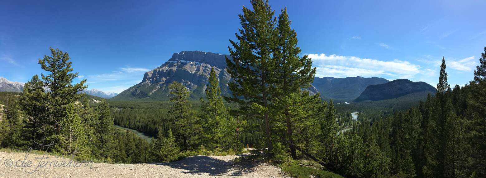
Use this route to travel to & from downtown Banff when staying at one of the Tunnel Mountain campgrounds or hotels. Take the slightly longer but eminently more scenic Tunnel Mountain Drive, which passes by one of Banff’s best viewpoints (Surprise Corner), one of its best hikes (Tunnel Mountain Summit Trail), and the access point to some of the best mountain biking in the park (the Tunnel Mountain Bench Trails), or else elect to shorten your journey by taking Tunnel Mountain Road all the way instead (~8km / ~1h). If you’re looking to change things up a bit on your return trip, you can choose to make a loop with Banff Avenue, connecting back onto Tunnel Mountain Road shortly before the highway (~14km / ~1.5h). A quick note regarding the elevation gain: while the majority of this route is fairly flat, no matter which variation you choose you’re going to have to climb up Tunnel Mountain Road for about one kilometre at an 8% grade; an eBike will help substantially if you are going to be making this trip multiple times during your stay, or you can use Roam Transit Route 2 to get you and your bike back up.
Spray river trail
<< contents // < moderate trails
trail stats
type |
loop | rating |
7/10 |
length |
~12km | time |
~2h |
elevation |
~520m | difficulty |
intermediate |
trailhead |
Spray River Trail parking lot (at the very end of Spray Ave, past the Fairmont Banff Springs) | ||
use |
hiking/trail-running (year-round), horseback-riding/mountain-biking (spring/summer/fall), fat-biking/snowshoeing/XC-skiing (winter) NO eBikes allowed |
||
map
description
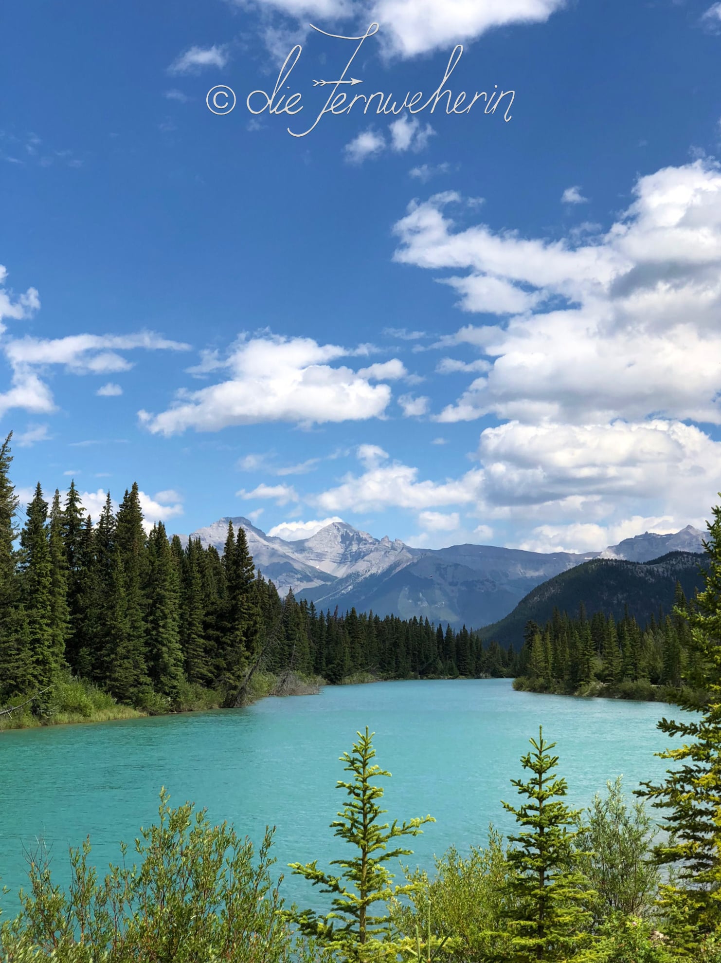
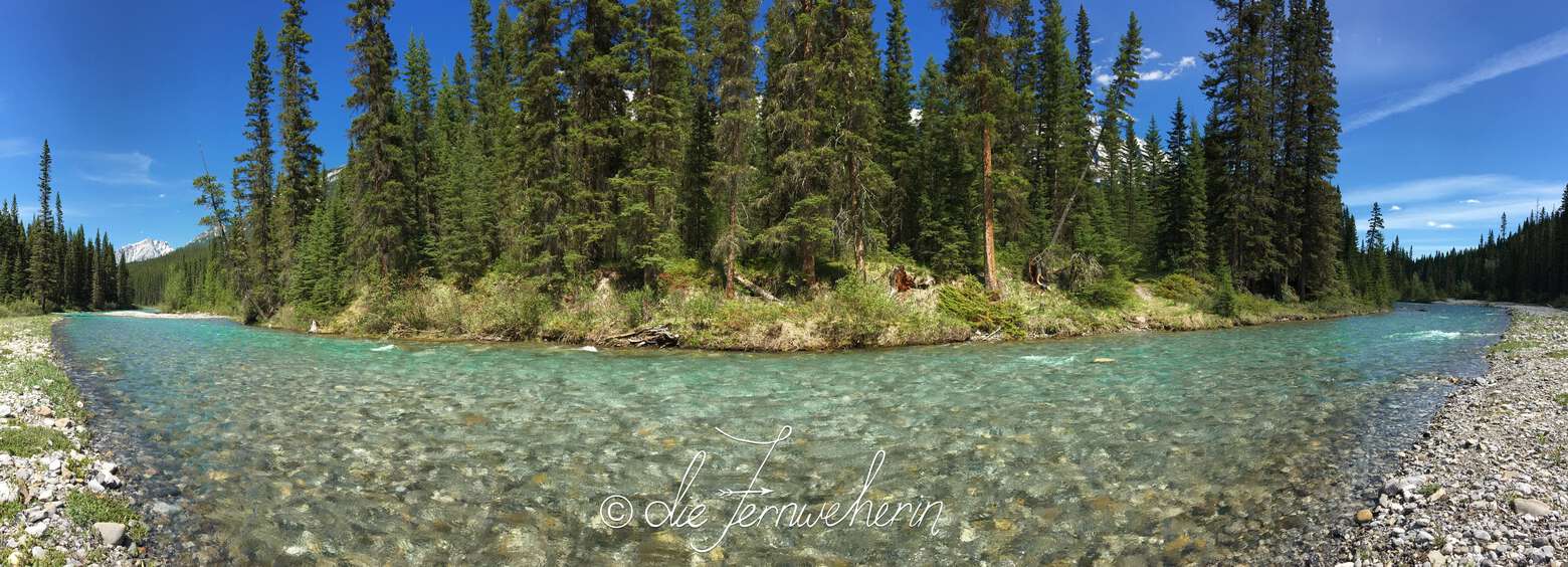
A bit longer and hillier than the previous options, this loop trail following the meandering crystal clear waters of Spray River is nevertheless a pleasant way to spend the day. Enjoy typical mountain scenery as you make your way along, and even a view of the Fairmont Banff Springs from one of the bridges connecting the two halves. This trail is less popular than some of the others around the town of Banff, but its peaceful solitude makes it all the more beautiful.
Star wars trail
<< contents // < moderate trails
trail stats
type |
loop | rating |
9/10 |
length |
~2.5km | time |
~0.25h |
elevation |
~110m | difficulty |
intermediate |
trailhead |
just off of Tunnel Mtn Dr, near the Buffalo Mountain Lodge | ||
use |
mountain-biking (spring/summer/fall) PEDAL-ASSIST eBikes allowed |
||
map
description
Part of the Tunnel Mountain Technical Trails network, built by the Bow Valley Mountain Bike Alliance in partnership with Parks Canada, this is one of the only dedicated mountain bike trails in Banff National Park. It does require a small amount of guts and physical skill to complete, as there is a bit of a steep descent down the Star Wars leg and then back up on Return of the Jedi, but you do not need to have a lot of technical skill to ride this trail. However, it’s a great option to develop said skills, as there are plenty of (completely optional) technical elements along the way, including berms, balance beams, and jumps. Many riders make several loops of this trail to practice sections.
Please note: There is no parking at the trailhead. Park at the Surprise Corner Viewpoint or at the Hoodoos Viewpoint. Access via the Hoodoos Trail or Tunnel Mountain Drive/Road (this additional distance is not included in the trail length above).
Banff ave trail
<< contents // < moderate trails
trail stats
type |
out & back ✲ | rating |
8/10 |
length |
~3.5km | time |
~0.75h |
elevation |
~115m | difficulty |
hard |
trailhead |
just off of the Banff Legacy Trail, 100m from the starting point along Banff Ave (the road) Tunnel Mountain Rd, about 1km from the Banff Rocky Mountain Resort |
||
use |
hiking/trail-running (year-round), horseback-riding/mountain-biking (spring/summer/fall), fat-biking (winter) PEDAL-ASSIST eBikes allowed |
||
map
description
Running almost parallel to its namesake roadway, this trail is full of short, steep climbs and drops as it threads through the trees. This fun, flowy trail can be ridden several different ways: out-and-back from either trailhead, point-to-point as a slight detour from the Banff Legacy Trail, or as a loop—either with Tunnel Mountain Drive & Banff Avenue (the road), or with the Tunnel Mountain Bench Trail using The Snake connector.
Please note: There is no parking lot at either trailhead. Park in downtown Banff, at the Hoodoos Viewpoint, or at one of the Tunnel Mountain campgrounds. Access via Banff Avenue & the Banff Legacy Trail, Tunnel Mountain Drive/Road, the Tunnel Mountain Campground Trail, or the Tunnel Mountain Bench Trail (this additional distance is not included in the trail length above).
<< contents
Difficult Trails
Mountain avenue
trail stats
type |
out & back | rating |
4/10 |
length |
~8km | time |
~1h |
elevation |
~250m | difficulty |
hard |
trailhead |
downtown Banff (assorted parking lots) Banff Upper Hot Springs parking lot |
||
use |
driving (year-round), road-biking (spring/summer/fall), fat-biking (winter) ALL eBikes allowed, including throttle eBikes |
||
map
description
If you’re looking to test your uphill endurance when road biking, then this is the route for you. From downtown Banff, it’s a constant climb for four kilometres at a 6% grade, at the end of which sits a large parking area. From here, the choice is yours whether to relax in the Banff Upper Hot Springs, ride the Banff Gondola, or hike the Sulphur Mountain Frontside (East) Trail. The way back down is a breeze, a welcome reward for your efforts
Hoodoos trail
<< contents // < difficult trails
trail stats
type |
out & back | rating |
7.5/10 |
length |
~8km ✲ | time |
~1.5h |
elevation |
~265m | difficulty |
challenging |
trailhead |
Surprise Corner parking lot (at the intersection of Buffalo St & Tunnel Mtn Dr) Hoodoos Viewpoint parking lot (Tunnel Mtn Rd, across from the entrance to Tunnel Mountain Village I Campground) |
||
use |
hiking/trail-running (year-round), mountain-biking (spring/summer/fall), fat biking/snowshoeing (winter) PEDAL-ASSIST eBikes allowed |
||
map
description
A mountainous substitute for Tunnel Mountain Drive/Road, this trail links the three Tunnel Mountain campgrounds with the town of Banff. At the top you’ll be treated to an amazing panoramic view of the hoodoos (striking columnar rock formations created by erosion) with the Bow River and Mount Rundle in the background. At the bottom is Surprise Corner, a famous viewpoint in town that overlooks the Fairmont Banff Springs. Along the trail itself, you’ll catch more glimpses of the Bow River and Mount Rundle, as well as Tunnel Mountain. Be prepared to either bike up & down a short set of stairs near the bottom of the trail, or else carry your bike over this section; please also note that bikes are not permitted on the Hoodoos Interpretive Trail (shown in green on the map above). Optional extensions to this trail include the Tunnel Mountain Bench Trail, or The Toe Trail.
The toe trail
<< contents // < difficult trails
trail stats
type |
point-to-point ✲ | rating |
10/10 |
length |
~6km | time |
~0.75h |
elevation |
~150m | difficulty |
challenging |
trailhead |
extension to the Tunnel Mountain Bench Trail or the Hoodoos Trail | ||
use |
hiking/mountain-biking/trail-running (spring/summer/fall) PEDAL-ASSIST eBikes allowed |
||
map
description
Extolled as some of the best singletrack in Banff National Park, this is an optional, exhilarating extension to the Tunnel Mountain Bench Trail, bypassing the easier (and shorter) Teddybear’s Picnic. The trail starts off winding through the trees, but the views soon open up over the Bow River. Expect some technical elements, a few steep climbs and descents, and a ton of exposure. Due to limited visibility along some parts of the trail, it’s strongly suggested that you ride counterclockwise (enter at the intersection with Don’s Bypass). Try adding on Stinky D (at the intersection with Coastline) for some extra fun.
Please note: This trail is an extension. In order to access this trail, you will have to travel at least partway along the Tunnel Mountain Bench Trail or the Hoodoos Trail first (distance varies based on where you start); this is not included in the trail length above.
Sulphur mountain
backside (west) trail
<< contents // < difficult trails
trail stats
type |
out & back ✲ | rating |
8/10 |
length |
~12km ✲ | time |
~3h |
elevation |
~885m ✲ | difficulty |
challenging |
trailhead |
extension to the Sundance Trail | ||
use |
hiking (year-round), horseback-riding/mountain-biking (spring/summer/fall), snowshoeing (winter) NO eBikes allowed |
||
map
description
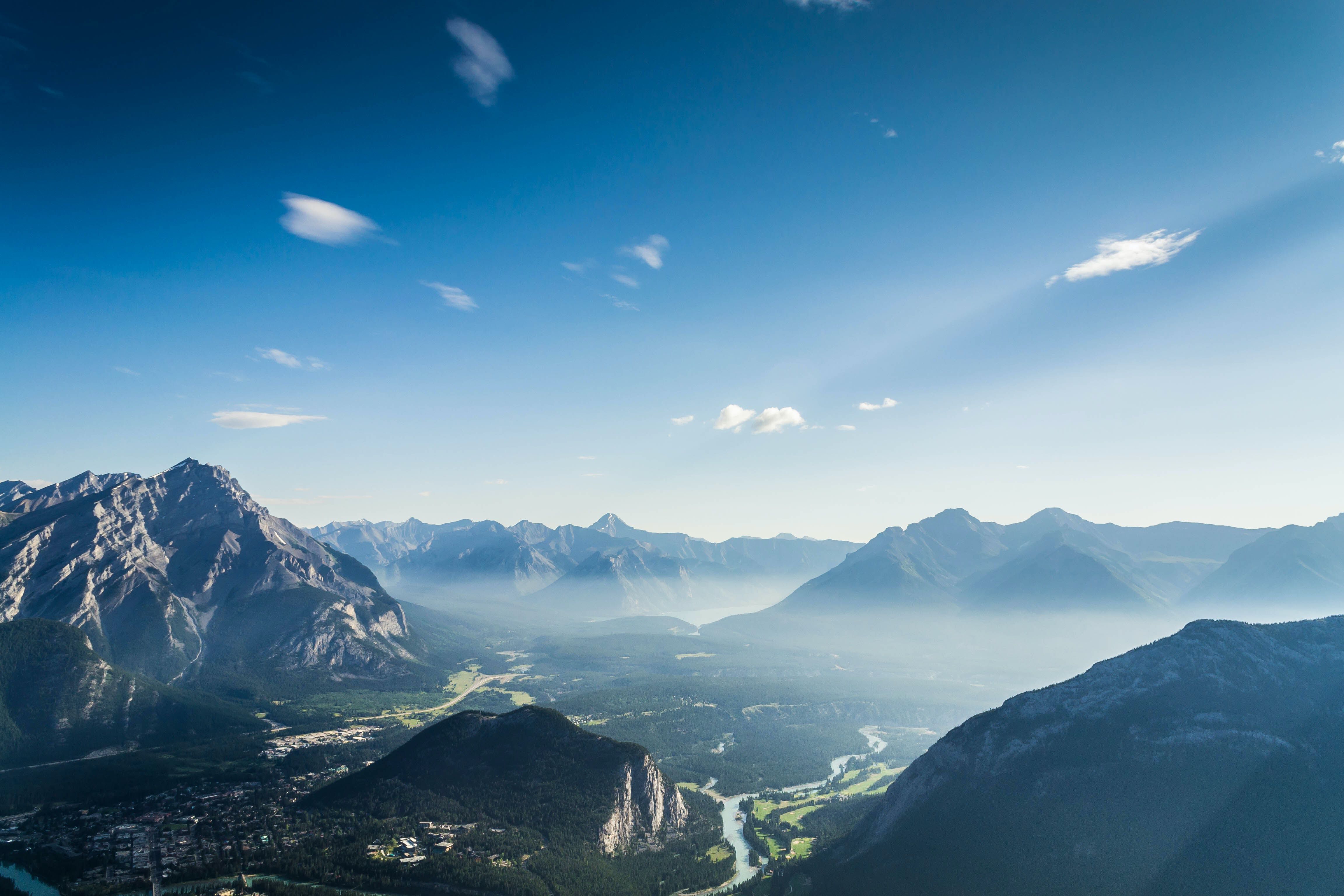
This is a money-saving alternative to taking the gondola up to the summit of Sulphur Mountain; however, be prepared to make equal payment in sweat on this gruelling climb. At the top you’ll be rewarded with a stunning panoramic view of the town of Banff and its surroundings (on a clear day, you can see all the way to Lake Minnewanka). If you’ve brought a bike lock, you can choose to explore further along the boardwalk to the Banff Gondola’s Upper Station, which houses—among other things—two award-winning restaurants and an excellent interpretive centre. Be aware that in order to access this trail, you will have to travel partway along the Sundance Trail first (~5km / ~0.3h).
Topp notch trail
<< contents // < difficult trails
trail stats
type |
loop ✲ | rating |
10/10 |
length |
~5.5km | time |
~0.75h |
elevation |
~300m | difficulty |
expert |
trailhead |
just off of Tunnel Mtn Dr, near the Buffalo Mountain Lodge | ||
use |
mountain-biking (spring/summer/fall) PEDAL-ASSIST eBikes allowed |
||
map
description
The jewel of the Tunnel Mountain Technical Trails network, this is one of a handful of biking-only trails in Banff National Park. Built by the Bow Valley Mountain Bike Alliance in partnership with Parks Canada, this trail is for experienced riders only. It’s packed with tons of technical features (both natural and man-made), sharp drops, and punchy climbs. When you reach the bottom, head back up for another go using Return of the Jedi from the Star Wars Trail (included in the total length above), or choose to continue on to the Hoodoos Trail instead.
Please note: There is no parking at the trailhead. Park at the Surprise Corner Viewpoint or at the Hoodoos Viewpoint. Access via the Hoodoos Trail or Tunnel Mountain Drive/Road (this additional distance is not included in the trail length above).
What’s your favourite bike trail in Banff? Are any of these new to you?
Please leave a comment to share your feedback on this post, and/or your own tips & experiences.
Thank you so much for reading!
Happy travels,