Boasting an area of 6500km2, Banff National Park is home to over 1600km of trails. And while you may think that the best ones must be found far from civilization, I’m here to tell you that you don’t even have to leave the town of Banff to get gorgeous panoramic views from a mountain summit, stroll alongside crystal clear—yet strikingly blue—glacial meltwater, or glimpse elusive wildlife. So, if you’re tired of commuting for an hour or more each day to access trails at tourist hotspots such as Lake Louise, or if you don’t want to venture too far from those all-important creature comforts, or even if you just want to explore the town of Banff a little bit more, then this post is for you! There’s a trail for anyone and everyone in Banff, no matter your skill or fitness level, so read on to find out which one is right for you.
Contents
Before Heading Out
Staying safe
Remember that while exploring the outdoors in Banff, you are responsible for your own safety. Always be well-prepared when setting out (check out my Hiking Safety Tips), and choose a trail that is suited to your experience & fitness level. If you are hiking as a family or group of friends, choose a trail suitable for the least experienced/fit member of your group.
Trail ratings
To help you choose an appropriate trail, I have provided stats, information on common usage, and a description of each one. All figures listed assume a full roundtrip from the trailhead. As I used a variety of sources to obtain the data, I have provided my calculations as rounded numbers (and yes, I use the metric system; if you’re more familiar with imperial measurements, i.e. miles & feet, please use a conversion calculator such as this one). Elevation gain is provided as a “gross” number (the actual number of metres that you have to ascend, without subtracting any elevation losses). And, last but not least, the difficulty of each trail is measured using the following seven-point scale:
difficulty | characteristics |
|---|---|
novice | suitable for beginner hikers with no experience or a low level of fitness usually accessible with strollers and/or mobility aids short (<5km) mostly flat path is wide & paved |
elementary | suitable for beginner hikers with little experience or a low level of fitness may be accessible with strollers and/or mobility aids fairly short (<10km) mostly flat; some gentle elevation gain/loss path is wide; may be paved or hard-packed; no rocks/roots present |
basic | suitable for beginner hikers with some experience and a rudimentary level of fitness usually not accessible with strollers and/or mobility aids fairly short (<10km) rolling elevation gain/loss path is fairly wide; usually unpaved, but generally firm; some small rocks/roots are present |
intermediate | suitable for intermediate hikers with moderate experience and level of fitness medium in length mostly rolling elevation gain/loss; some short steeper sections or longer gradual climbs path is beginning to narrow; may be somewhat loose (ex. gravel/sand/mud); small roots/rocks may be present throughout |
hard | suitable for intermediate hikers with additional experience and/or a higher level of fitness variable length (may be short or long depending on other factors) few flat sections; elevation gain/loss is often steep and/or fairly long path is somewhat narrow; may be loose; small to medium roots/rocks are typically present throughout |
challenging | suitable for advanced hikers with ample experience, technical skills, and level of fitness variable length (typically longer) few flat sections; elevation gain/loss is often major, with very steep and/or long ascending & descending sections path is usually narrow; may be loose; medium to large roots/rocks are typically present throughout may involve some “scrambling” up piles of rock, navigating scree slopes, etc. |
expert | suitable for advanced hikers with extensive experience, highly developed technical skills, and an excellent level of fitness variable length few to no flat sections; elevation gain/loss is very steep & variable path may be very narrow; may be very loose; large roots/rocks are typically present throughout often require “scrambling”, navigating scree slopes, etc. |
Trails on die Fernweherin are assigned a grade based on their most difficult criterion. For example, a short paved path that has a steep hill would be graded as “intermediate”, even though the majority of the trail may fit into the “novice” category.
When reading the trail stats, an asterisk (✲) denotes that the information as written may be altered by the trail user (e.g., the overall distance may be shortened by choosing a different trailhead); typically, this will be described longhand in the trail’s description.
Trail etiquette
It is important to note that many of the hiking trails in Banff National Park are multi-use trails. This means that you may come across bikers, horse-riders, and more. The general rule of thumb is that bikers yield to hikers, and everyone yields to horse-riders. However, this is not always possible; for example, if someone on a bike is travelling at speed around a blind corner or downhill, especially on a narrow trail, they may not see you in time to stop and yield safely. Stay alert, pay attention to your surroundings, and be prepared to step aside as needed.
<< contents
Easy Trails
- Bow river trail
- Bow falls trail
- Fenland trail
- Marsh trail
- Sundance trail
- Vermillion lakes road
- Tunnel mountain campground trail
- Tunnel mountain bench trail
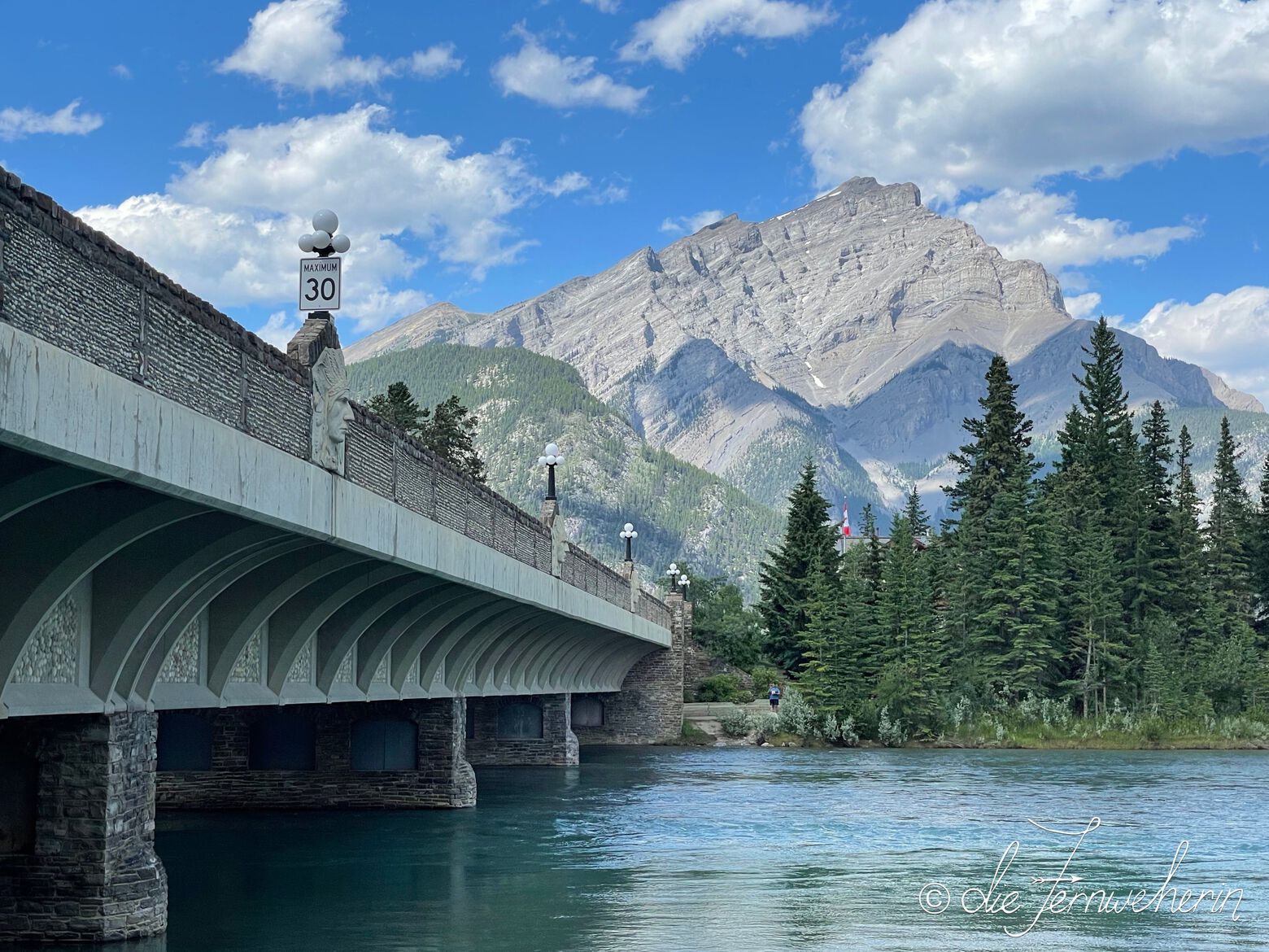
Bow river trail
trail stats
type |
out & back | rating |
7/10 |
length |
~4.5km ✲ | time |
~1h ✲ |
elevation |
minimal | difficulty |
novice |
trailhead |
Surprise Corner parking lot (at the intersection of Buffalo St & Tunnel Mtn Dr) Central Park (near the intersection of Buffalo St & Banff Ave) |
||
use |
biking/jogging/walking (year-round) | ||
map
description
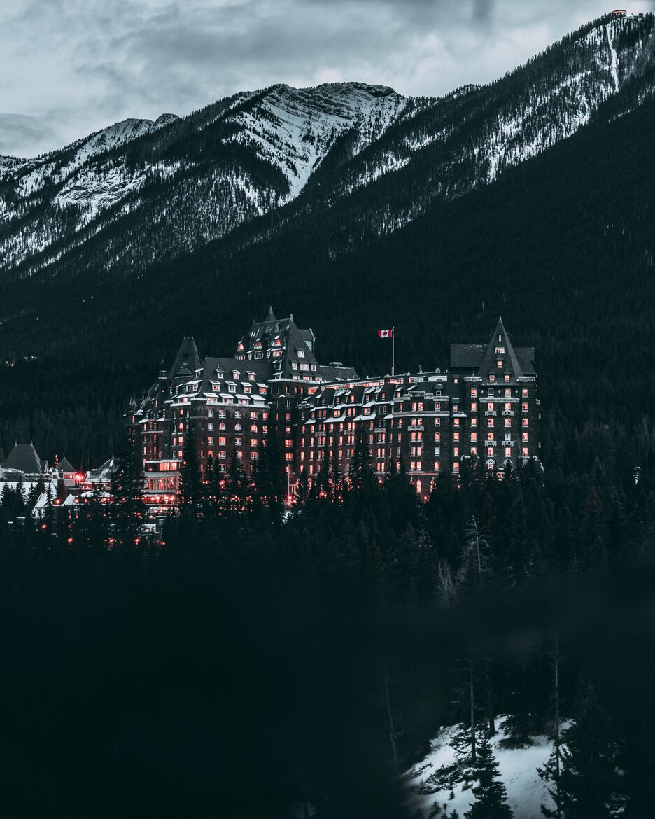
This picturesque trail follows the northern shoreline of the Bow River as it flows past downtown Banff, stretching from the Surprise Corner viewpoint to Railway Avenue on the other end of town. It’s an easy stroll with views of the river and surrounding mountains, as well as the castle-like Fairmont Banff Springs. The entire path is paved, so this trail is wheelchair & stroller-friendly. Many visitors complete only part of the trail; either from Surprise Corner to downtown Banff (~3km / ~0.5h), or around Central Park itself (~1km / ~0.25h). The trail is accessible year-round, but if you are planning on walking it in the winter be sure to wear crampons as it can get quite icy.
Bow falls trail
<< contents // < easy trails
trail stats
type |
out & back | rating |
7/10 |
length |
~3.5km ✲ | time |
~1h ✲ |
elevation |
~20m | difficulty |
novice |
trailhead |
Bow Falls parking lot (on Bow Falls Ave behind the Fairmont Banff Springs) | ||
use |
biking/jogging/walking (year-round ✲) | ||
map
description
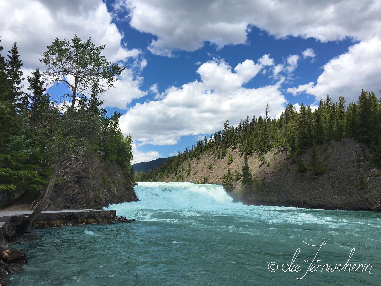
A mirror of the Bow River Trail, this path follows the river’s southern bank, from the falls themselves to Sundance Road. Consequently, it offers many of the same views, although this option swaps the Insta-worthy scene of the Fairmont in exchange for two different angles of picture-perfect Bow Falls. And, much like its counterpart, it is primarily trafficked between its easternmost point and downtown Banff (~3km / ~0.5h). If you would like, you can combine the two by heading west from either trailhead, crossing the river at the pedestrian bridge, and then heading east along the opposite trail to the mirror viewpoint (~4km / ~1h). Whichever route you choose, during the summer it’s worth your while to take a slight detour off the trail into beautiful Cascade Gardens, just ahead of the Bow River bridge at the T-intersection. Bow Falls Trail is best enjoyed after the snow has melted, as the stairs leading to the upper viewpoint are closed in the winter. However, the lower lookout (just next to the parking lot) can be visited year-round, as can the remainder of the trail—simply detour around the stairs using Bow Falls Avenue.
Fenland trail
<< contents // < easy trails
trail stats
type |
loop | rating |
4/10 |
length |
~2km | time |
~0.5h |
elevation |
~55m | difficulty |
elementary |
trailhead |
Fenland Trail parking lot (on Mt Norquay Rd between Vermillion Lakes Rd & the Banff sign) | ||
use |
biking/jogging/walking (year-round), snowshoeing/XC-skiing (winter) | ||
map
description
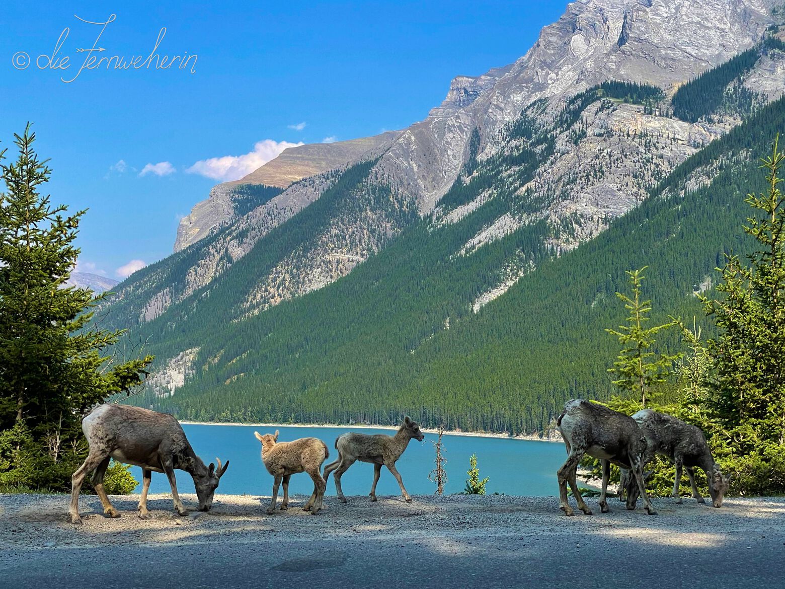
This is an easy walk through the wetlands on the edge of Banff’s town limits. While the views themselves aren’t spectacular, it’s a popular place to spot wildlife up close, including elk, deer, and a variety of birds. Due to the nature of its surroundings, the path is often muddy in the spring or after it rains, and the standing water is prime breeding ground for mosquitos in the summer, so make sure to bring bug spray.
Marsh trail
<< contents // < easy trails
trail stats
type |
loop | rating |
5/10 |
length |
~3km ✲ | time |
~1h |
elevation |
~100m | difficulty |
elementary |
trailhead |
Cave & Basin parking lot (at the end of Cave Ave) | ||
use |
biking/jogging/walking (year-round), horseback-riding (spring/summer/fall), snowshoeing (winter) | ||
map
description
Another short loop through wetlands, this time formed by the run-off from Sulphur Mountain’s natural hot springs. This is a great family-friendly path with many educational signs. Due to the nature of its surroundings, the path is often muddy in the spring or after it rains, and the standing water is prime breeding ground for mosquitos in the summer, so make sure to bring bug spray. If you’d rather avoid the mud entirely, there is a small contained boardwalk loop (~1km / ~0.25h) at the beginning of the trail. Try combining this with Sundance Trail & Sundance Canyon Trail.
Sundance trail
<< contents // < easy trails
trail stats
type |
out & back | rating |
6/10 |
length |
~8km | time |
~2.5h |
elevation |
~130m | difficulty |
elementary |
trailhead |
Cave & Basin parking lot (at the end of Cave Ave) | ||
use |
biking/jogging/walking (year-round), horseback-riding (spring/summer/fall), snowshoeing/XC-skiing (winter) | ||
map
description
This trail links Cave & Basin National Historic Site with nearby Sundance Canyon. Another one of Banff’s easy scenic walks along the Bow River, it features extensive views of the bright blue water winding through verdant forests with the omnipresent mountains in the background. The path is completely paved, and while there is some elevation gain it’s very gentle, so this trail is wheelchair & stroller-friendly. There are plenty of benches along the way if you feel like pausing. This trail is fairly popular, but because it’s so wide it really doesn’t feel busy. This is a great connector trail if you’re looking for a little extra mileage. Try starting off with the Marsh Trail, tacking on the Sundance Canyon Trail, or—if you’re up for a full-day’s worth of hiking—continue onto the Sulphur Mountain Backside (West) Trail.
Vermillion lakes road
<< contents // < easy trails
trail stats
type |
out & back | rating |
5/10 |
length |
~9km | time |
~2.5h |
elevation |
~35m | difficulty |
elementary |
trailhead |
Fenland Trail parking lot (on Mt Norquay Rd between Vermillion Lakes Rd & the Banff sign) Fenlands Rec Centre parking lot (opposite side of the road) |
||
use |
biking/driving/jogging/walking (year-round) | ||
map
description
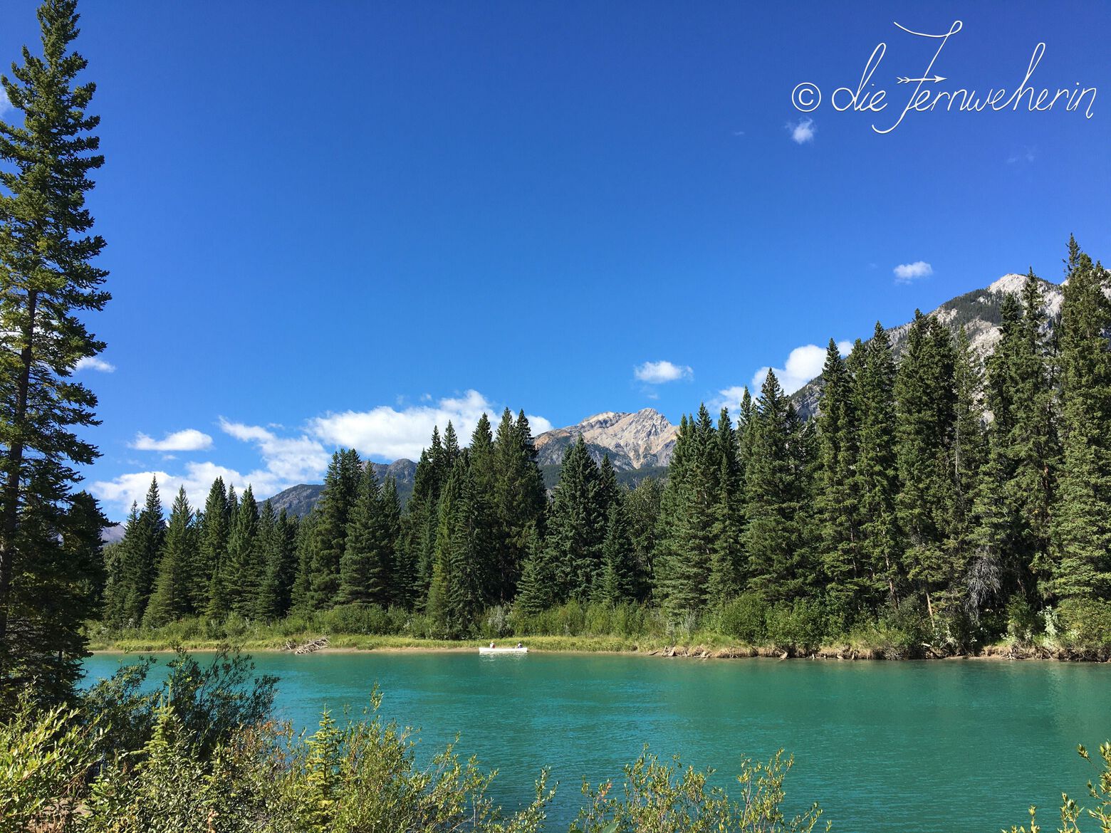
This is an enjoyable path for an extended walk. While these wetland lakes are not the pure blue of glacial melt, they are beautiful in their own right—especially if you visit during sunrise or sunset, when the red, pink, and orange hues of the sky are reflected in the water. This is also one of the best places in Banff to view the iconic Mount Rundle, and the area is frequented by elk, deer, and various birds. It’s a great place to start or end your day in quiet reflection, with several spots to stop, take a seat on a bench, and relax. This path pairs nicely with the Fenland Trail loop.
Tunnel mountain
campground trail
<< contents // < easy trails
trail stats
type |
loop | rating |
6/10 |
length |
~6.5km | time |
~2h |
elevation |
~160m | difficulty |
basic |
trailhead |
Hoodoos Viewpoint parking lot (on Tunnel Mtn Rd, across from the entrance to Tunnel Mountain Village I Campground) various starting points throughout all three Tunnel Mountain campgrounds |
||
use |
biking/jogging/walking (year-round), snowshoeing (winter) | ||
map
description
Want to stretch your legs first thing in the morning, entertain bored kids in the afternoon, or work off a few extra calories in the evening before you indulge in hot dogs and s’mores? If you’re staying at one of the three Tunnel Mountain campgrounds, you’re just steps away from enjoying a pleasant stroll surrounded by mountain scenery whenever it strikes your fancy. If you’re staying in town, it’s a short drive, bus trip, or bike ride up Tunnel Mountain Drive/Road to access this trail.
Tunnel mountain
bench trail
<< contents // < easy trails
trail stats
type |
loop | rating |
7.5/10 |
length |
~9.5km | time |
~3h |
elevation |
~85m | difficulty |
basic |
trailhead |
Hoodoos Viewpoint parking lot (on Tunnel Mtn Rd, across from the entrance to Tunnel Mountain Village I Campground) | ||
use |
biking/hiking/trail-running (year-round) | ||
map
description
This trail is an amalgamation of many that has earned its own name thanks to being such a popular combination. The views are spectacular, and it’s a great family-friendly hike. Stay alert as you go, as this is an extremely popular trail for bike traffic. The typical route to follow is: Don’s Bypass → Teddybear’s Picnic → Coastline → The Spine → Tunnel Mountain Campground → Hoodoos. If you’re looking for more exercise, try swapping out Banff Ave for The Spine, and The Toe for Teddybear’s Picnic.
<< contents
Moderate Trails
- Sundance canyon trail
- Tunnel mountain summit trail
- Hoodoos trail
- Golf course drive
- Spray river trail
- Banff ave trail
- The toe trail
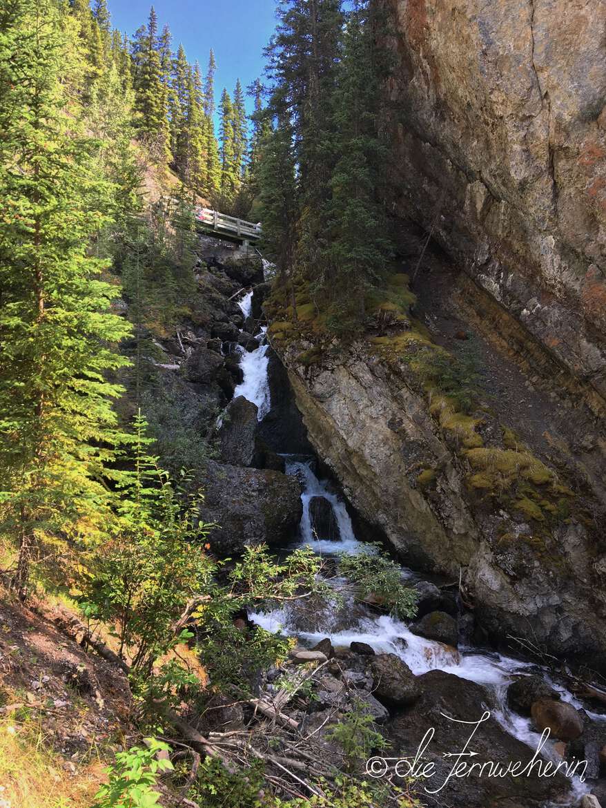
Sundance canyon trail
trail stats
type |
loop | rating |
7.5/10 |
length |
~2km | time |
~1.5h |
elevation |
~220m | difficulty |
intermediate |
trailhead |
extension of the Sundance Trail | ||
use |
hiking/trail-running (year-round) | ||
map
description
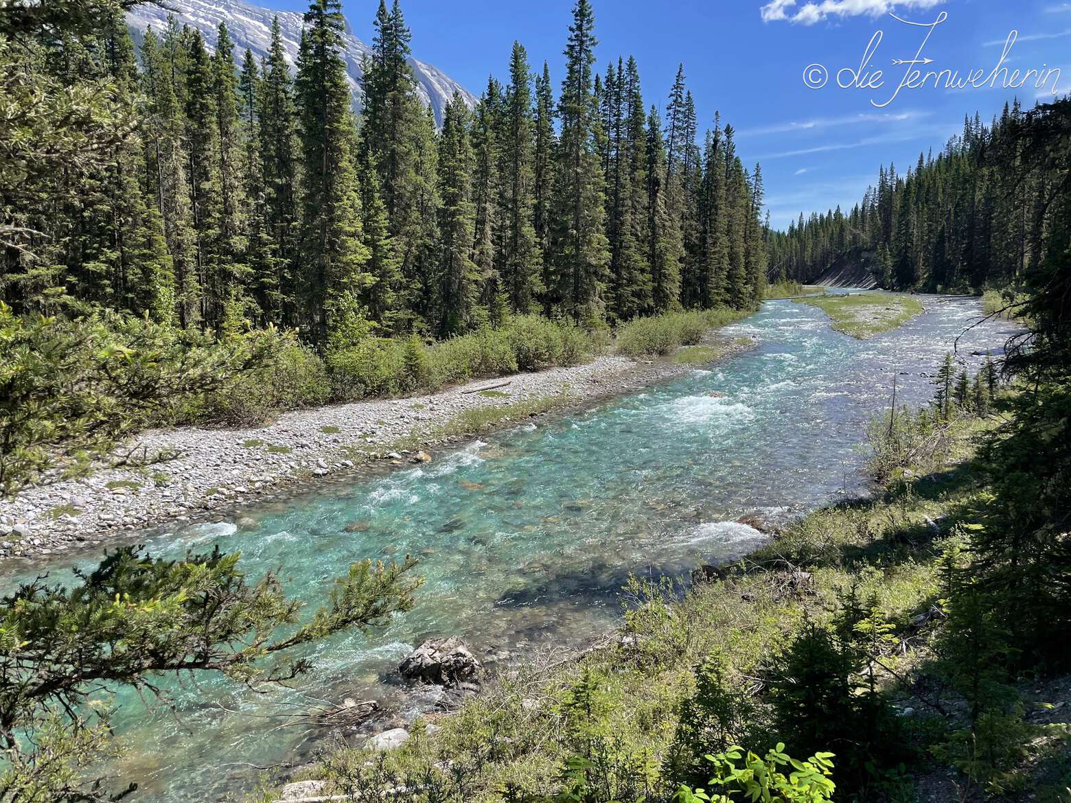
This is a great, family-friendly hike that offers splendid views for a little effort. A short, rustic trail through a small canyon just outside of town, it features a cascading waterfall, craggy moss-covered rocks, a creek that’s at turns raging and playfully burbling, views of the surrounding mountain peaks, and lush forest. Be sure to bring bug spray in the summer, and crampons if you are visiting while there’s snow on the ground (mid fall to mid spring), because the path gets very slick.
Please note: This trail is an extension. In order to access this trail, you will have to complete the Sundance Trail first; this is not included in the trail length above.
Tunnel mountain
summit trail
<< contents // < moderate trails
trail stats
type |
out & back | rating |
8/10 |
length |
~4.5km | time |
~2h |
elevation |
~300m | difficulty |
intermediate |
trailhead |
Upper Tunnel Mountain Trail parking lot (halfway along Tunnel Mtn Drive, about 1km from Buffalo St & 1.5km from Tunnel Mtn Rd) Lower Tunnel Mountain Trail parking lot (on St Julien Rd, between Wolverine St & St Julien Way) |
||
use |
hiking/trail-running (year-round) | ||
map
description
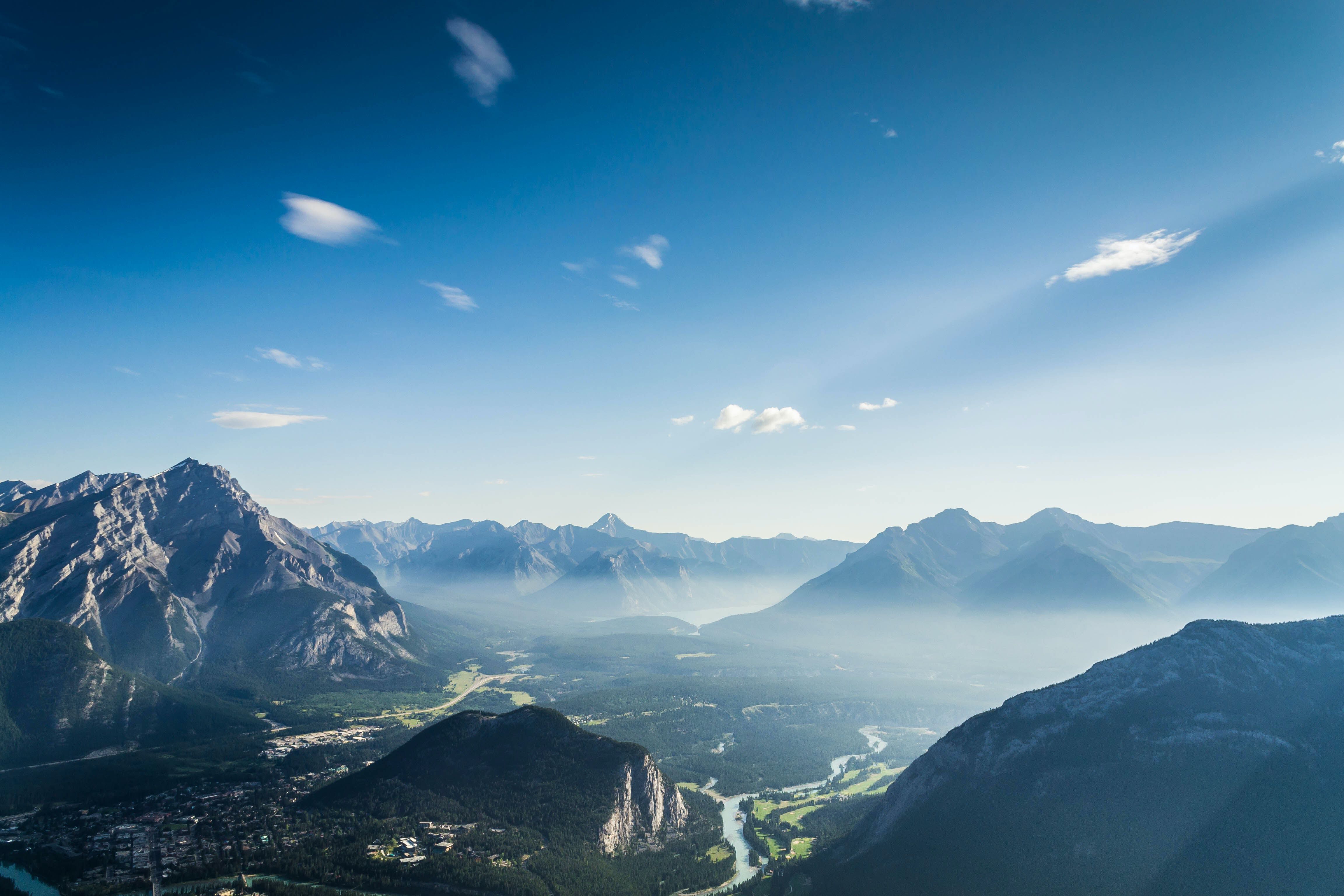
Want to summit a mountain but don’t want to spend an entire day doing so? Want panoramic views of the town of Banff, the castle-like Fairmont Banff Springs, Mount Rundle, and the Bow Valley? Want to be able to torch some calories, then walk straight back down and enjoy lunch or dinner in the heart of downtown Banff? Then the Tunnel Mountain hike is for you! While the grade is steep at times, the switchbacks make the elevation gain manageable, and even if you are somewhat out of shape you should be able to complete this hike—just take your time with the climb, and stop for a breather when you need one. Remember to bring plenty of water, especially in the summer; in the winter, crampons are highly recommended.
Hoodoos trail
<< contents // < moderate trails
trail stats
type |
out & back | rating |
7.5/10 |
length |
~8km ✲ | time |
~3h |
elevation |
~265m | difficulty |
intermediate |
trailhead |
Surprise Corner parking lot (at the intersection of Buffalo St & Tunnel Mtn Dr) Hoodoos Viewpoint parking lot (Tunnel Mtn Rd, across from the entrance to Tunnel Mountain Village I Campground) |
||
use |
biking/hiking/trail-running (year-round), snowshoeing (winter) | ||
map
description
This trail links the three Tunnel Mountain campgrounds with the town of Banff. At the top you’ll be treated to an amazing panoramic view of the hoodoos (striking columnar rock formations created by erosion) with the Bow River and Mount Rundle in the background. At the bottom is Surprise Corner, a famous viewpoint in town that overlooks the Fairmont Banff Springs. Along the trail itself, you’ll catch more glimpses of the Bow River and Mount Rundle, as well as Tunnel Mountain. This trail is super under-utilized, so if you’re looking to hike in solitude, this is the one to choose.
Golf course drive
<< contents // < moderate trails
trail stats
type |
loop | rating |
6/10 |
length |
~11km | time |
~3.5h |
elevation |
~70m | difficulty |
intermediate |
trailhead |
Bow Falls parking lot (on Bow Falls Ave behind the Fairmont Banff Springs) | ||
use |
driving (spring/summer/fall), biking/jogging/walking (year-round) | ||
map
description
Enjoy a relaxing stroll along the Bow River, around the Fairmont Banff Springs’ renowned 27-hole golf course, and back behind the castle-like hotel itself. This quiet road is popular with local wildlife, and is perfect for escaping the crowds of downtown Banff. The walking itself is easy, but the distance earns this trail an intermediate rating. Combine it with the Bow Falls Trail for an even longer option.
Spray river trail
<< contents // < moderate trails
trail stats
type |
loop | rating |
7/10 |
length |
~12km | time |
~5h |
elevation |
~520m | difficulty |
intermediate |
trailhead |
Spray River Trail parking lot (at the very end of Spray Ave, past the Fairmont Banff Springs) | ||
use |
biking/hiking/trail-running (year-round), horseback-riding (spring/summer/fall), snowshoeing/XC-skiing (winter) | ||
map
description
A bit longer and hillier than some of the previous options, this loop trail following the meandering crystal clear waters of Spray River is nevertheless a pleasant way to spend the day. Enjoy typical mountain scenery as you make your way along, and even a view of the Fairmont Banff Springs from one of the bridges connecting the two halves. This trail is less popular than some of the others around the town of Banff, but its peaceful solitude makes it all the more beautiful. Since this is a longer trail, make extra sure that you bring plenty of water and snacks.
Banff ave trail
<< contents // < moderate trails
trail stats
type |
out & back ✲ | rating |
6/10 |
length |
~3.5km | time |
~2h |
elevation |
~115m | difficulty |
intermediate |
trailhead |
just off of the Banff Legacy Trail, 100m from the starting point along Banff Ave (the road) on Tunnel Mountain Rd, about 1km from the Banff Rocky Mountain Resort |
||
use |
biking/hiking/trail-running (year-round), horseback-riding (spring/summer/fall) | ||
map
description
Running almost parallel to its namesake roadway, this trail is full of short, steep ups and downs as it threads through the trees. If you’re into trail running, this is a great option. Stay alert as you go, as this is another popular trail for mountain bikers. This trail can be completed a couple different ways: out-and-back from either trailhead, or as a loop with the Banff Legacy Trail & Tunnel Mountain Road. You can also tack it on to the Tunnel Mountain Bench Trail using The Snake connector.
Please note: There is no parking lot at either trailhead. Park in downtown Banff, at the Hoodoos Viewpoint, or at one of the Tunnel Mountain campgrounds. Access via Banff Avenue & the Banff Legacy Trail, Tunnel Mountain Drive/Road, the Tunnel Mountain Campground Trail, or the Tunnel Mountain Bench Trail (this additional distance is not included in the trail length above).
The toe trail
<< contents // < moderate trails
trail stats
type |
point-to-point ✲ | rating |
7.5/10 |
length |
~6km | time |
~2.25h |
elevation |
~150m | difficulty |
intermediate |
trailhead |
extension to the Tunnel Mountain Bench Trail or the Hoodoos Trail | ||
use |
biking/hiking/trail-running (spring/summer/fall) | ||
map
description
This trail starts off winding through the trees, but the views soon open up over the Bow River. Expect a few steep climbs and descents, and a ton of exposure. Due to limited visibility along some parts of the trail (there are a lot of blind corners), it’s extra important that you stay alert for bike traffic, and strongly suggested that you hike counterclockwise (enter at the intersection with Don’s Bypass).
Please note: This trail is an extension. In order to access this trail, you will have to travel at least partway along the Tunnel Mountain Bench Trail or the Hoodoos Trail first (distance varies based on where you start); this is not included in the trail length above.
<< contents
Difficult Trails
Sulphur mountain
frontside (east) trail
trail stats
type |
out & back | rating |
8/10 |
length |
~11km | time |
~5h |
elevation |
~750m | difficulty |
hard |
trailhead |
Banff Upper Hot Springs parking lot (at the end of Mountain Ave) | ||
use |
hiking (year-round) | ||
map
description
Probably one of the best-known hikes in Banff, the Sulphur Mountain Trail is a free alternative to taking the gondola up to the summit. Climb steadily up the mountain on a series of switchbacks that wind through dense rocky mountain forest, and emerge at the top next to the upper gondola station. Here you’ll have a bird’s-eye view of the town of Banff and the surrounding valley, cradled by craggy mountain peaks. On a clear day, you can see all the way to Lake Minnewanka. Explore further by walking along the boardwalk to the Cosmic Ray Station—which offers further breathtaking views—or else enjoy the facilities in the Upper Gondola Station—Sky Bistro in particular is an award-winning restaurant, and there is an excellent interpretive centre that kids are sure to love. If you’re visiting in the winter, you can catch a ride down on the gondola for free; the remainder of the year, choose between paying half price for a ride to the base, heading back the way you came, or hiking down the opposite side on Sulphur Mountain Backside (West) Trail.
Sulphur mountain
backside (west) trail
<< contents // < difficult trails
trail stats
type |
out & back ✲ | rating |
8/10 |
length |
~12km ✲ | time |
~5h |
elevation |
~885m ✲ | difficulty |
hard |
trailhead |
extension to the Sundance Trail and/or Sulphur Mountain Frontside (East) Trail | ||
use |
biking/hiking (year-round), snowshoeing (winter) | ||
map
description
Searching for solitude? Take the road less travelled by—literally—and hike up the old Cosmic Ray Road along the back of Sulphur Mountain. There’s nothing particularly technical about this ascent, but like its partner it’s a long, steady, uphill slog. The rewards for your perseverance are the breathtaking views, and the absolute peace & quiet on this trail (it’s very likely that you won’t see a soul between stepping off of the Sundance Trail and arriving at the summit). If you want to experience both sides of the mountain, combine this trail with the Sulphur Mountain Frontside (East) Trail (~13km / ~5h). Arrange a vehicle shuttle at each end, take transit, or—if your feet are up to it—you can walk back into town along Cave Avenue or Mountain Avenue.
Please note: This trail is an extension. In order to access this trail, you will have to travel partway along the Sundance Trail first (~5km / ~1h roundtrip); this is not included in the trail length above.
<< contents
What’s your favourite hike in Banff? Are any of these trails new to you?
Please leave a comment to share your feedback on this post, and/or your own tips & experiences.
Thank you so much for reading!
Happy travels,