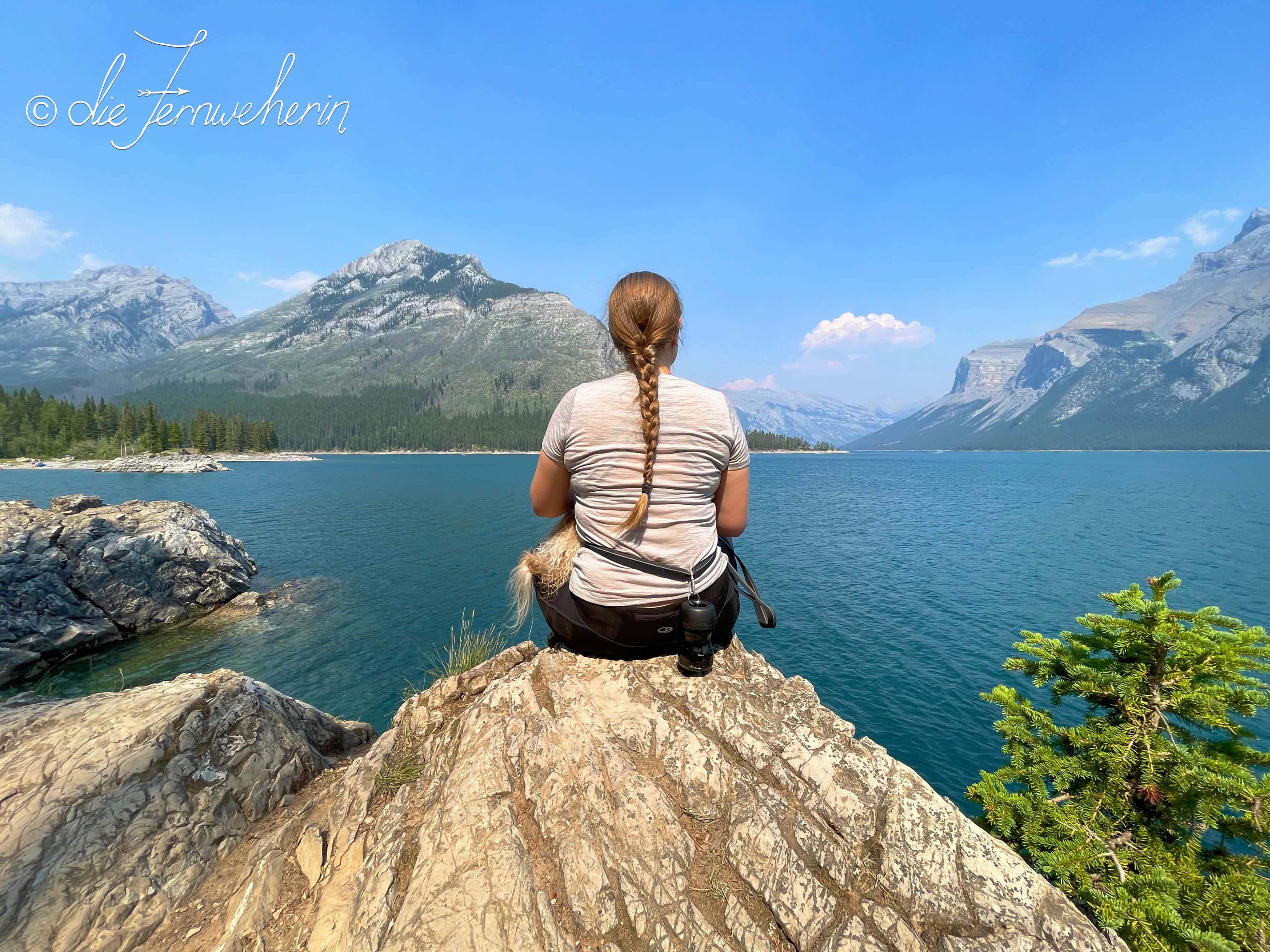
Latticed by more than 1600km of trails, Banff National Park is one of the best places in the Rockies to go hiking. Of course, with such an extensive network, no one article can cover all of Banff’s beautiful trails! Having explored the ones within the town of Banff, it’s now time to venture slightly further afield. Therefore, this post focuses on trails that are located around the townsite (within a radius of 10~15 kilometres), including the areas of Lake Minnewanka, Mount Norquay, and Sunshine Meadows. Most of these trails are accessible by either public transit or shuttle bus, making them perfect for those visitors to Banff who don’t have a car, or who want to minimize their carbon footprint.
There’s a trail for anyone and everyone in Banff, no matter your skill or fitness level, so read on to find out which one is right for you.
Contents
Before Heading Out
Staying safe
Remember that while exploring the outdoors in Banff, you are responsible for your own safety. Always be well-prepared when setting out (check out my Hiking Safety Tips), and choose a trail that is suited to your experience & fitness level. If you are hiking as a family or group of friends, choose a trail suitable for the least experienced/fit member of your group.
Trail difficulty ratings
To help you choose an appropriate trail, I have provided stats, information on common usage, and a description of each one. All figures listed assume a full roundtrip from the trailhead. As I used a variety of sources to obtain the data, I have provided my calculations as rounded numbers (and yes, I use the metric system; if you’re more familiar with imperial measurements, i.e. miles & feet, please use a conversion calculator such as this one). Elevation gain is provided as a “gross” number (the actual number of metres that you have to ascend, without subtracting any elevation losses). And, last but not least, the difficulty of each trail is measured using the following seven-point scale:
difficulty | characteristics |
|---|---|
novice | suitable for beginner hikers with no experience or a low level of fitness usually accessible with strollers and/or mobility aids short (<5km) mostly flat path is wide & paved |
elementary | suitable for beginner hikers with little experience or a low level of fitness may be accessible with strollers and/or mobility aids fairly short (<10km) mostly flat; some gentle elevation gain/loss path is wide; may be paved or hard-packed; no rocks/roots present |
basic | suitable for beginner hikers with some experience and a rudimentary level of fitness usually not accessible with strollers and/or mobility aids fairly short (<10km) rolling elevation gain/loss path is fairly wide; usually unpaved, but generally firm; some small rocks/roots are present |
intermediate | suitable for intermediate hikers with moderate experience and level of fitness medium in length mostly rolling elevation gain/loss; some short steeper sections or longer gradual climbs path is beginning to narrow; may be somewhat loose (ex. gravel/sand/mud); small roots/rocks may be present throughout |
hard | suitable for intermediate hikers with additional experience and/or a higher level of fitness variable length (may be short or long depending on other factors) few flat sections; elevation gain/loss is often steep and/or fairly long path is somewhat narrow; may be loose; small to medium roots/rocks are typically present throughout |
challenging | suitable for advanced hikers with ample experience, technical skills, and level of fitness variable length (typically longer) few flat sections; elevation gain/loss is often major, with very steep and/or long ascending & descending sections path is usually narrow; may be loose; medium to large roots/rocks are typically present throughout may involve some “scrambling” up piles of rock, navigating scree slopes, etc. |
expert | suitable for advanced hikers with extensive experience, highly developed technical skills, and an excellent level of fitness variable length few to no flat sections; elevation gain/loss is very steep & variable path may be very narrow; may be very loose; large roots/rocks are typically present throughout often require “scrambling”, navigating scree slopes, etc. |
Trails on die Fernweherin are assigned a grade based on their most difficult criterion. For example, a 1km trail that has a wide, paved path but also a steep hill would be graded as “intermediate”, even though the majority of the trail may fit into the “novice” category.
When reading the trail stats, an asterisk (✲) denotes that the information as written may be altered by the trail user (e.g., the overall distance may be shortened by choosing a different trailhead); typically, this will be described longhand in the trail’s description.
Trail etiquette
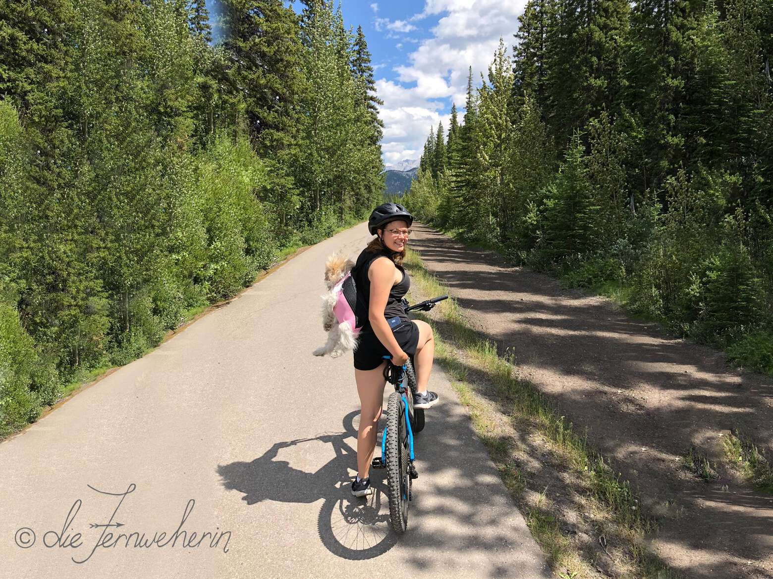
It is important to note that many of the hiking trails in Banff National Park are multi-use trails. This means that you may come across bikers, horse-riders, and more. The general rule of thumb is that bikers yield to hikers, and everyone yields to horse-riders. However, this is not always possible; for example, if someone on a bike is travelling at speed around a blind corner or downhill, especially on a narrow trail, they may not see you in time to stop and yield safely. Stay alert, pay attention to your surroundings, and be prepared to step aside as needed.
<< contents
Easy Trails
- Lower bankhead trail
- Cascade ponds trail
- Johnson lake trail
- Stewart canyon trail
- Bankhead connector trail
Lower bankhead trail
trail stats
type |
loop | rating |
9/10 |
length |
~1km | time |
~0.5h |
elevation |
~35m | difficulty |
elementary |
trailhead |
Lower Bankhead parking lot (on the west link of Lake Minnewanka Scenic Dr) | ||
use |
jogging/walking (year-round ✲) | ||
map
description
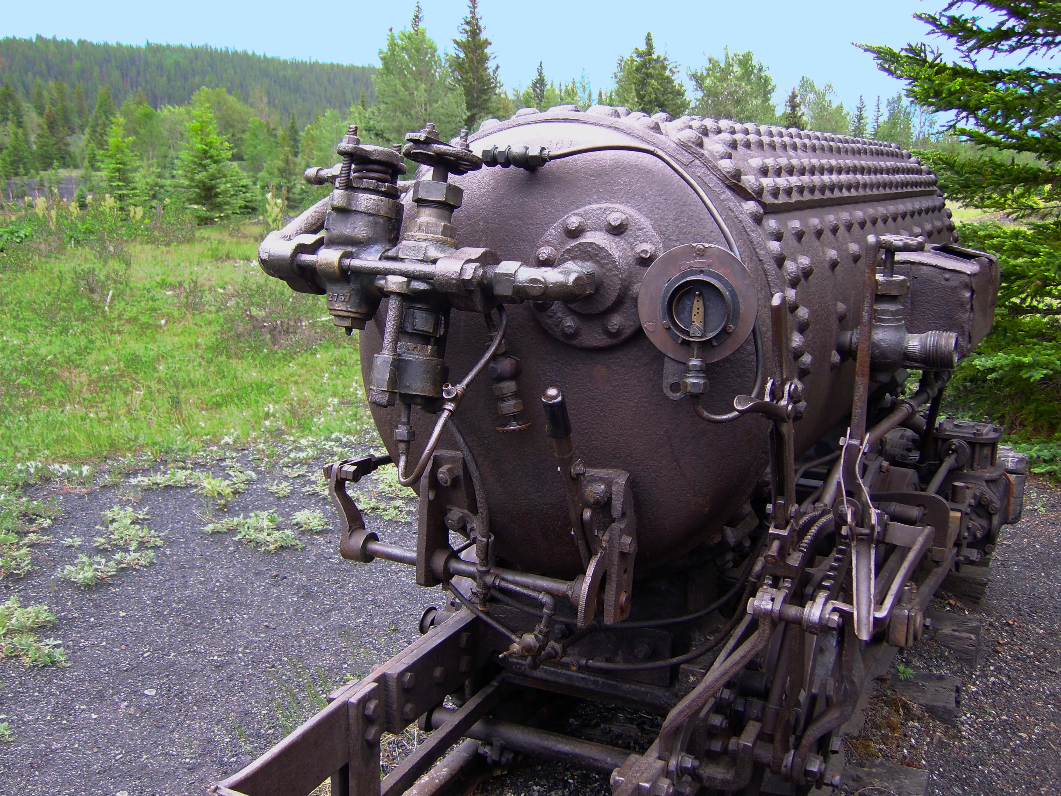
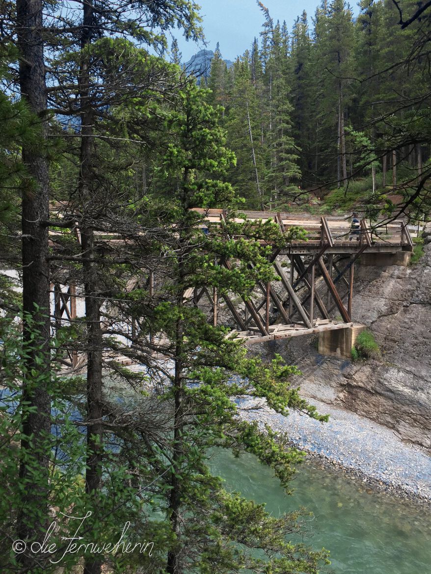
Lower Bankhead is, in my opinion, one of the most underrated trails in Banff National Park. It’s easy to access, being just off the road to Lake Minnewanka; easy to complete, since it’s super short & mostly flat; and it’s a source of easy to digest information about the history of the area, as it explores the remains of the former coal-mining community of Bankhead. As such, it’s perfect for kids (although not stroller-friendly, as there is a fairly long set of stairs at the beginning of the trail), history buffs, and anyone who wants to go on an easy walk in the mountains and look at cool things like an abandoned locomotive. Make sure to wear crampons if you’re visiting while there’s snow on the ground, because the stairs can get icy. Up for more? Try adding on Cascade Ponds by way of the Bankhead Connector Trail for an enjoyable half-day trip.
Please note: There is no parking at the trailhead in the winter. The west leg of the Lake Minnewanka Scenic Drive loop road is closed to vehicle traffic from November to May each year. Access during this time by parking at the Lake Minnewanka parking lot and walking or biking along the road to the trailhead, or at the Cascade Ponds parking lot and using the Bankhead Connector Trail. This additional distance is not included in the trail length above.
Cascade ponds trail
<< contents // < easy trails
trail stats
type |
loop | rating |
6/10 |
length |
~2.5km ✲ | time |
~0.5h |
elevation |
~85m | difficulty |
elementary |
trailhead |
Cascade Ponds parking lot (just off Lake Minnewanka Scenic Dr near the highway overpass) | ||
use |
biking/jogging/walking (year-round), snowshoeing/XC-skiing (winter) | ||
map
description
This lovely trail is found just across the highway from the town of Banff. A leisurely loop around several picturesque ponds, it’s a great choice for a family-friendly stroll no matter what the season or time of day. Although the path isn’t fully paved, it’s even enough to be accessible for strollers, and it’s rarely muddy. If you want to put your feet up and stay awhile, there are plenty of picnic sites here (complete with firepits), but if you’d rather explore the area further you can hike to the Bankhead ghost town using the Bankhead Connector Trail, or to nearby Johnson Lake using the Water Tower Trail.
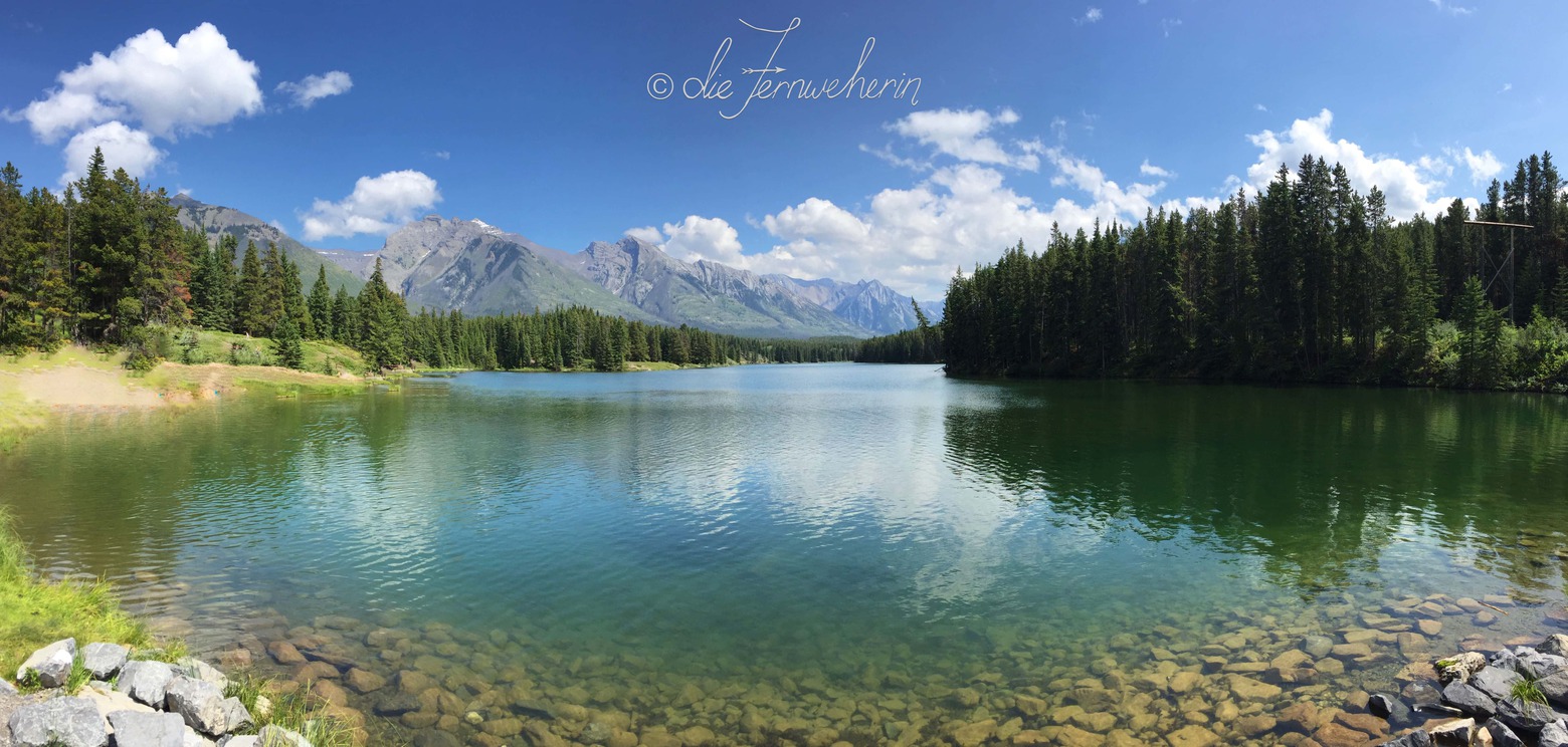
Johnson lake trail
<< contents // < easy trails
trail stats
type |
loop | rating |
8/10 |
length |
~3km | time |
~1h |
elevation |
~70m | difficulty |
basic |
trailhead |
Johnson Lake parking lot (at the end of Johnson Lake Rd, off of Lake Minnewanka Scenic Dr) | ||
use |
biking/hiking/trail-running (year-round), snowshoeing (winter) | ||
map
description
If you’re a repeat visitor to Banff and are looking for something new to do, or if you’re a first-timer and like to travel off the beaten path, then this trail is for you. While Johnson Lake is not by any means unpopular (especially amongst locals) it is notably less-visited than its big sister up the road, Lake Minnewanka, so it’s a welcome escape from the crowds while you take in the spectacular views of both Johnson Lake and Cascade Mountain. Plus, it’s the only spot in Banff where you’ll find a swing right beside the trail! If you want to keep going after completing the loop, you can connect to Cascade Ponds via the Water Tower Trail.
Stewart canyon trail
<< contents // < easy trails
trail stats
type |
out & back | rating |
7/10 |
length |
~3km ✲ | time |
~1h ✲ |
elevation |
~155m ✲ | difficulty |
basic ✲ |
trailhead |
Lake Minnewanka parking lot (on Lake Minnewanka Scenic Dr) | ||
use |
hiking/trail-running (year-round), snowshoeing (winter) | ||
map
description
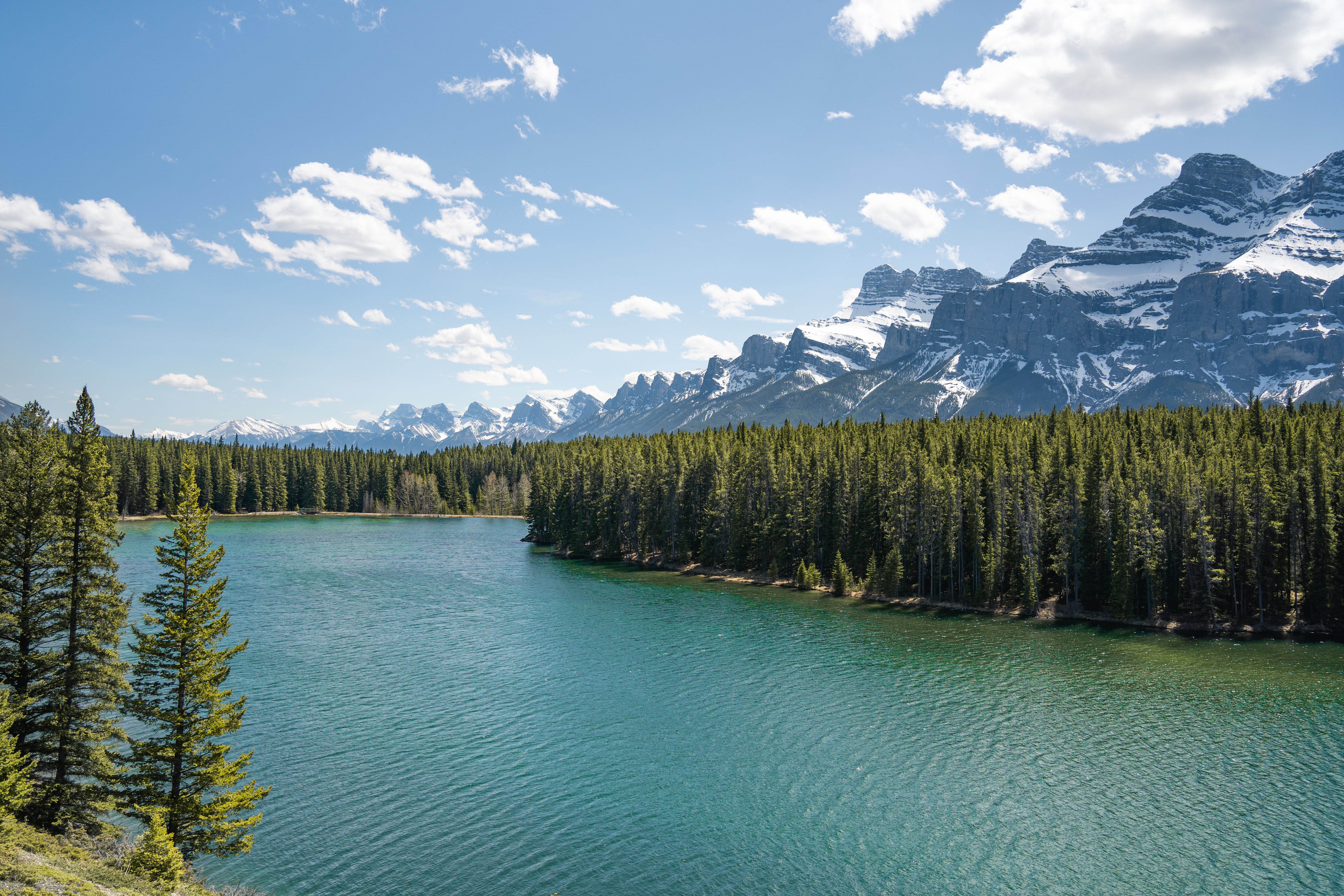
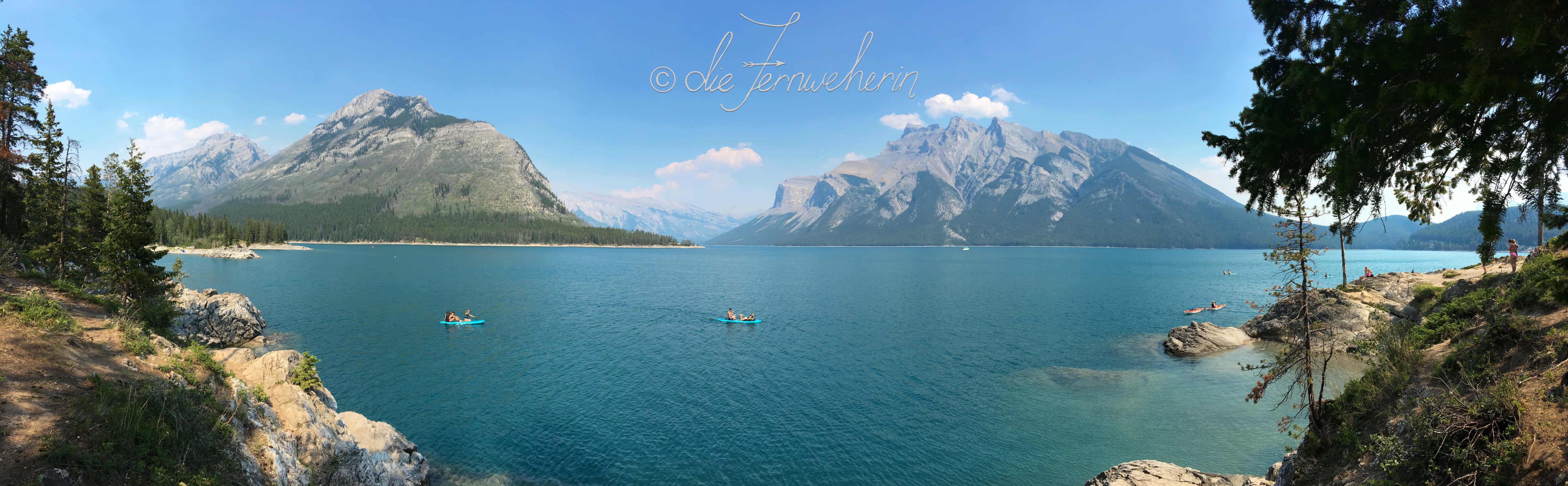
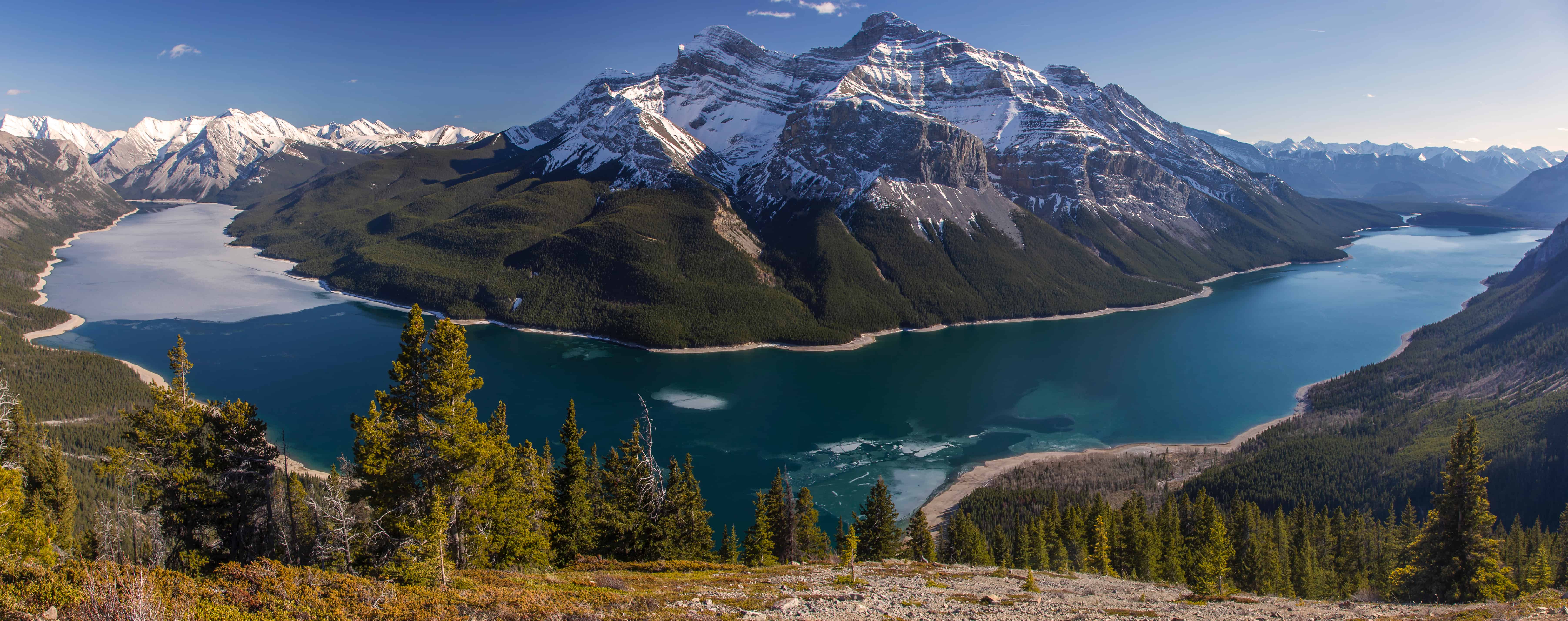
This trail hugs the rocky shore of Lake Minnewanka, offering up beautiful views of Banff’s biggest lake, and leads to a wooden bridge spanning the Cascade River. It’s a fantastic trail year-round, but be sure to bring crampons if you’re visiting in the winter. From the bridge, if you’re up for a longer, intermediate-level hike, you can continue into the canyon itself (~3.5km / ~90m 𝚫 / 1h extra), or along the shoreline on the Lake Minnewanka Lakeside Trail. If you’re an experienced hiker and up for a full day on the trail, you can make the gruelling (but gorgeous) trek to Aylmer Lookout. Bear in mind that all three of these extensions to the main trail are subject to seasonal restrictions from mid-July to mid-September; these measures are put in place by Parks Canada to keep both people and wildlife safe.
Bankhead connector trail
<< contents // < easy trails
trail stats
type |
out & back | rating |
5/10 |
length |
~4.5km | time |
~1.5h |
elevation |
~150m | difficulty |
basic |
trailhead |
Cascade Ponds parking lot (just off Lake Minnewanka Scenic Dr near the highway overpass) Lower Bankhead parking lot (on the west link of Lake Minnewanka Scenic Dr) |
||
use |
biking (year-round), hiking/trail-running (spring/summer/fall), snowshoeing/XC-skiing (winter) | ||
map
description
This trail connects Cascade Ponds with Lower Bankhead, following the old Canadian Pacific rail line along the way. The views on this trail aren’t going to knock your socks off, but it’s easy, and if you’re looking to stretch your legs or minimize your time spent in a vehicle while exploring around Cascade Mountain, it fits the bill. This is a popular mountain biking trail, so be sure to stay alert while you hike.
<< contents
Moderate Trails
- Water tower trail
- Cascade trail
- Upper stoney lookout trail
- Eohippus lake trail
- Healy creek trail
- Lake minnewanka lakeside trail
- Sunshine meadows trail
- Cascade falls trail
- C-level cirque trail
Water tower trail
trail stats
type |
out & back | rating |
7/10 |
length |
~9km | time |
~3h |
elevation |
~275m | difficulty |
basic |
trailhead |
Johnson Lake parking lot (at the end of Johnson Lake Rd, off of Lake Minnewanka Scenic Dr) Cascade Ponds parking lot (just off Lake Minnewanka Scenic Dr near the highway overpass) |
||
use |
biking (year-round), hiking/trail-running (spring/summer/fall), snowshoeing (winter) | ||
map
description
This trail connects Johnson Lake with nearby Cascade Ponds, following the escarpment above the Trans-Canada Highway (Hwy 1) and passing by—you guessed it—a water tower along the way. It offers fantastic views of both the surrounding mountains (especially iconic Rundle & Cascade), and the Bow Valley below. This is a popular mountain biking trail, so use caution when travelling on foot, particularly around corners.
Cascade trail
<< contents // < easy trails
trail stats
type |
out & back | rating |
5/10 |
length |
~12.5km ✲ | time |
~4.5h ✲ |
elevation |
~265m ✲ | difficulty |
intermediate |
trailhead |
Upper Bankhead parking lot (on the west link of Lake Minnewanka Scenic Dr) | ||
use |
biking/hiking/trail-running (year-round), snowshoeing/XC-skiing (winter) | ||
map
description
As an old fire road, this trail doesn’t feature much in the way of views, but there’s a silver lining to that. It’s much less popular than some of the other options in the area, so if you’re getting sick of the crowds around Lake Minnewanka, it’s a great spot for a peaceful stroll. About one kilometre from the trailhead you’ll find an optional side trail heading off to the right; I highly recommend taking this detour, which leads to small but pretty Tessa Falls (~2km / ~100m 𝚫 / ~0.5h).
Please note: There is no parking at the trailhead in the winter. The west leg of the Lake Minnewanka Scenic Drive loop road is closed to vehicle traffic from November to May each year. Access during this time by parking at the Lake Minnewanka parking lot and walking or biking along the road to the trailhead. This additional distance is not included in the trail length above.
Upper stoney
lookout trail
<< contents // < moderate trails
trail stats
type |
out & back ✲ | rating |
7/10 |
length |
~4.5km | time |
~1.5h |
elevation |
~230m | difficulty |
intermediate |
trailhead |
Mount Norquay parking lot (at the end of Mt Norquay Rd) | ||
use |
biking (spring/summer/fall), hiking/trail-running (year-round), snowshoeing (winter) | ||
map
description
This trail meanders through a typical mountain forest of lichen-covered lodgepole pine & spruce, with occasional peek-a-boo glimpses of the Bow Valley through the trees along the way, and leads to a lookout with a breathtakingly magnificent view of the Fairholme Range. When choosing whether to head back along the upper part of the loop or to double back the way you came, keep in mind that the upper path is much narrower and has a fair amount of exposure, so if you have small children or suffer from a fear of heights, it’s probably best to double back. It’s extra important that you stay alert for bike traffic on this trail, as due to the limited visibility, narrow path, and sheer edges, bikers may not be able to safely yield to you. And finally, if you’re using this trail in late spring or the summer months, be sure to bring bug spray, as mosquitoes also enjoy the shade; if you’re hiking it in late fall, winter, or early spring, I strongly suggest you wear crampons (and possibly bring poles).
Eohippus lake trail
<< contents // < moderate trails
trail stats
type |
out & back | rating |
8/10 |
length |
~10km | time |
~3h |
elevation |
~300m | difficulty |
intermediate |
trailhead |
extension to the Healy Pass Trail | ||
use |
hiking/trail-running (summer/fall) | ||
map
description
If you’re looking to get away from…well…everything, then this trail will serve up the solitude and peacefulness that you’re craving. This road-less-travelled-by winds its way through alpine meadows, mountain passes, and forests of larch trees, ending up at a clear, serene lake in (quite literally) the middle of nowhere. The views of Monarch Mountain are absolutely stunning, especially in mid to late September when the larches change colour, earning this trail the moniker “Yellow Brick Road”.
Please note: This trail is an extension. In order to access this trail, you will have to complete the Healy Pass Trail first; this is not included in the trail length above.
Healy creek trail
<< contents // < moderate trails
trail stats
type |
out & back | rating |
4/10 |
length |
~11km | time |
~3.5h |
elevation |
~315m | difficulty |
intermediate |
trailhead |
Healy/Brewster parking lot (on Sunshine Rd) extension to the Sundance Trail |
||
use |
biking/hiking/trail-running (year-round), horseback-riding (summer), snowshoeing/XC-skiing (winter) | ||
map
description
This trail follows an old fire road that stretches between Sunshine Road and the end of Sundance Trail, and features occasional pleasant views of a burbling creek, but not much else. Honestly, its biggest claim to fame is being mistaken for Healy Pass Trail, the trailhead for which is found further up the road. Healy Creek Trail, on the other hand, is primarily used by backcountry horse-riders, so be prepared for the path to be fairly muddy, especially in the spring or after heavy rain; in the summer, bug spray is a must. If you do choose to hike this trail, I recommend tacking on the Sundance Canyon Trail.
Lake minnewanka
lakeside trail
<< contents // < moderate trails
trail stats
type |
out & back | rating |
7/10 |
length |
~12.5km | time |
~4h |
elevation |
~340m | difficulty |
intermediate |
trailhead |
extension to the Stewart Canyon Trail | ||
use |
biking/hiking/trail-running (year-round ✲) | ||
map
description
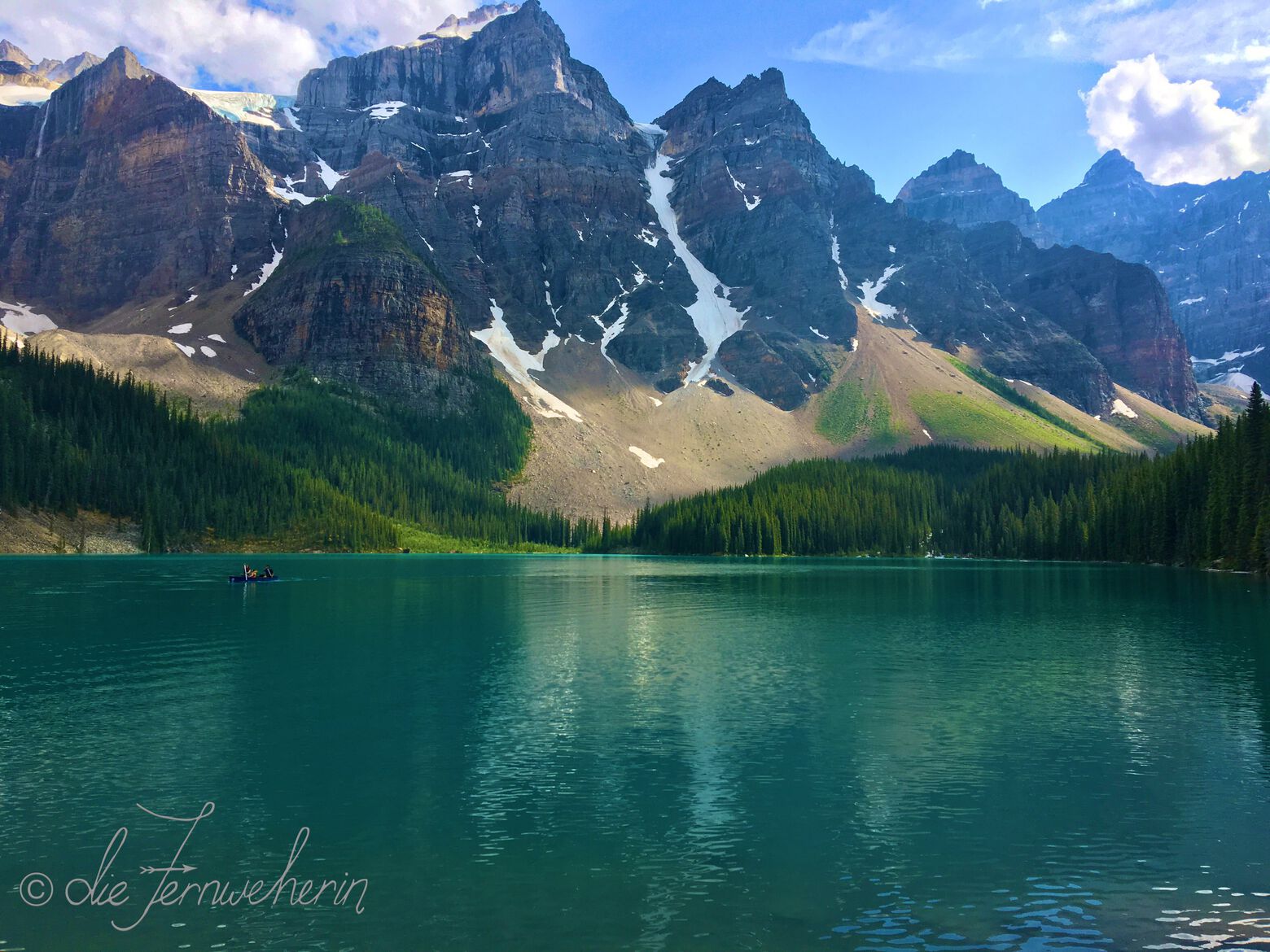
The daytrip version of this trail begins just after the Stewart Canyon bridge, follows the northern shoreline of Lake Minnewanka, and ends at Aylmer Junction. It’s a pleasant hike, featuring uninterrupted views of Banff’s biggest lake and the varied mountain peaks that surround it, and offers an opportunity to stretch your legs without too much change in elevation. If you’re an experienced hiker and up for even more of a challenge, you can make the gruelling (but gorgeous) trek to Aylmer Lookout, or continue further along the lakeshore on the backcountry camping route, which extends for almost 50 kilometres more. Bear in mind that this trail, and its extensions, are subject to seasonal restrictions from mid-July to mid-September; these measures are put in place by Parks Canada to keep both people and wildlife safe.
Please note: This trail is an extension. In order to access this trail, you will have to complete the Stewart Canyon Trail first; this is not included in the trail length above.
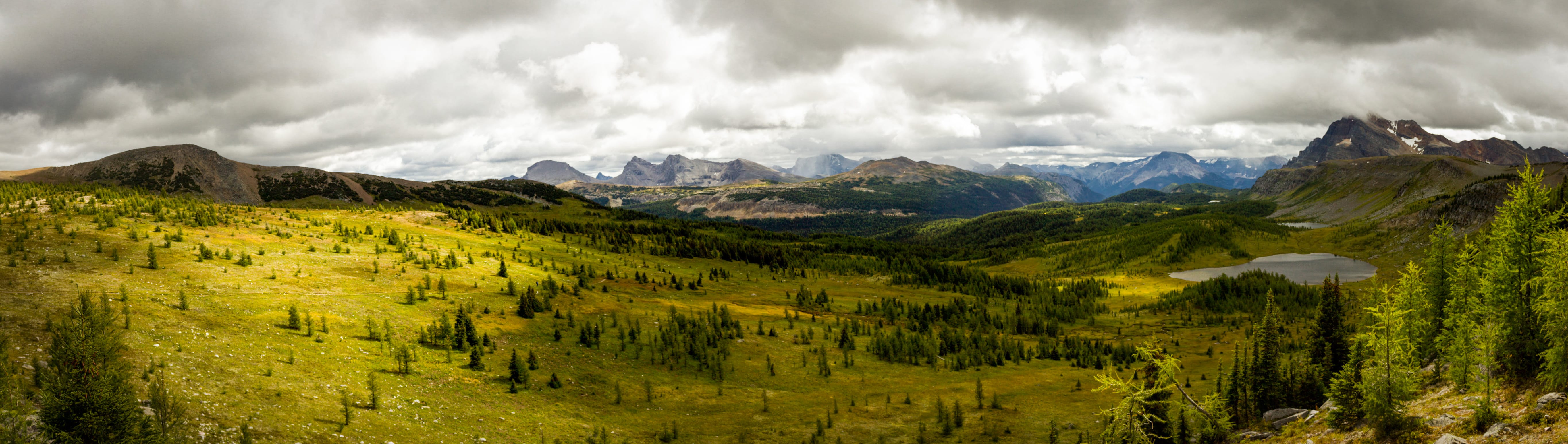
Sunshine meadows trail
<< contents // < moderate trails
trail stats
type |
loop | rating |
10/10 |
length |
~12km | time |
~4h |
elevation |
~555m | difficulty |
intermediate |
trailhead |
Sunshine Village parking lot (at the end of Sunshine Rd) | ||
use |
hiking/trail-running (summer/fall) | ||
map
description
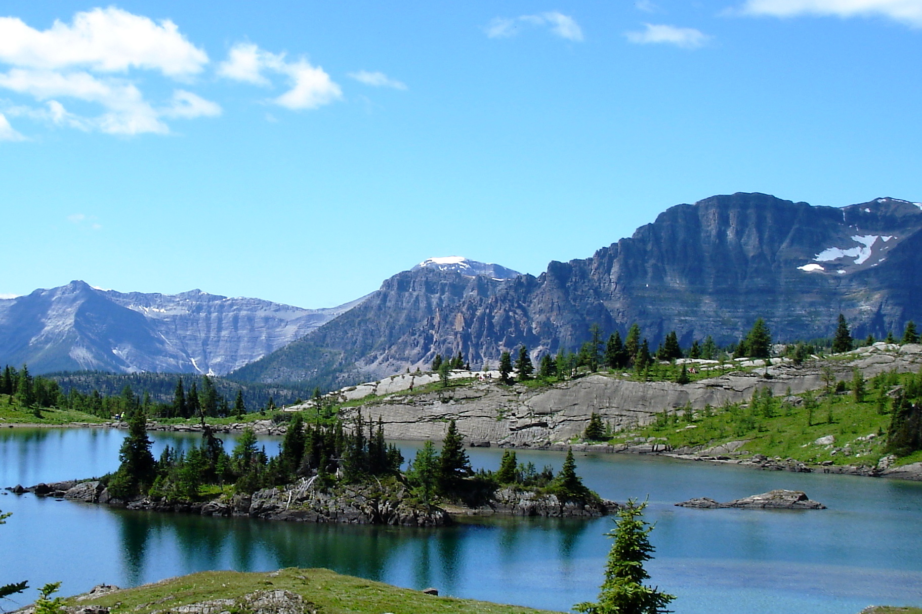
Sunshine Meadows is a true jewel in Banff’s mountainous crown of trails, having at one point been named the number one day hike in all of Canada by Lonely Planet. Featuring beautiful panoramic views of the surrounding mountains, three unbelievably vibrant blue lakes, and fields full of wildflowers in the summer & forests of golden larches in the fall, this trail is not to be missed! And because this network of trails is nestled in the middle of Sunshine Village—one of Banff’s Big 3 ski resorts in the winter—many of these sights are accessible to those who would otherwise be unable to enjoy them, thanks to all that ski hill infrastructure. So if you are out of shape, suffer from arthritis, have small children, or are otherwise unable to complete the full hike, you can make things easier by taking the Standish Chairlift up to the midpoint. From there, you can choose to hike out & back to Rock Isle Lake (~3km / ~155m 𝚫 / ~1h), the Monarch Viewpoint (~6km / ~220m 𝚫 / ~1.5h), or Grizzly & Laryx Lakes (~6.5km / ~315m 𝚫 / ~1.75h). If those options still sound like too much for you, then you can elect to just make a loop of the boardwalk around the top of the chairlift (~1km / ~0.25h).
Please note: The “intermediate” rating for this route relies on using the Sunshine Gondola to access the starting point. If the ticket price ($74 roundtrip per adult) is too steep, or if you really want to bring your dog with you (pets are not permitted on the gondola), access to the trails themselves is still possible by hiking up either the Banff Ave ski trail (~12km / ~700m 𝚫 / ~4h) or the Healy Pass Trail; however, the additional distance and elevation gain incurred would put this trail firmly in the challenging category.
Cascade falls trail
<< contents // < moderate trails
trail stats
type |
out & back | rating |
7/10 |
length |
~1.5km | time |
~0.75h |
elevation |
~150m | difficulty |
hard |
trailhead |
Cascade Falls parking lot (on Lake Minnewanka Scenic Dr, opposite the turnoff to Cascade Ponds) | ||
use |
hiking (summer) | ||
map
description
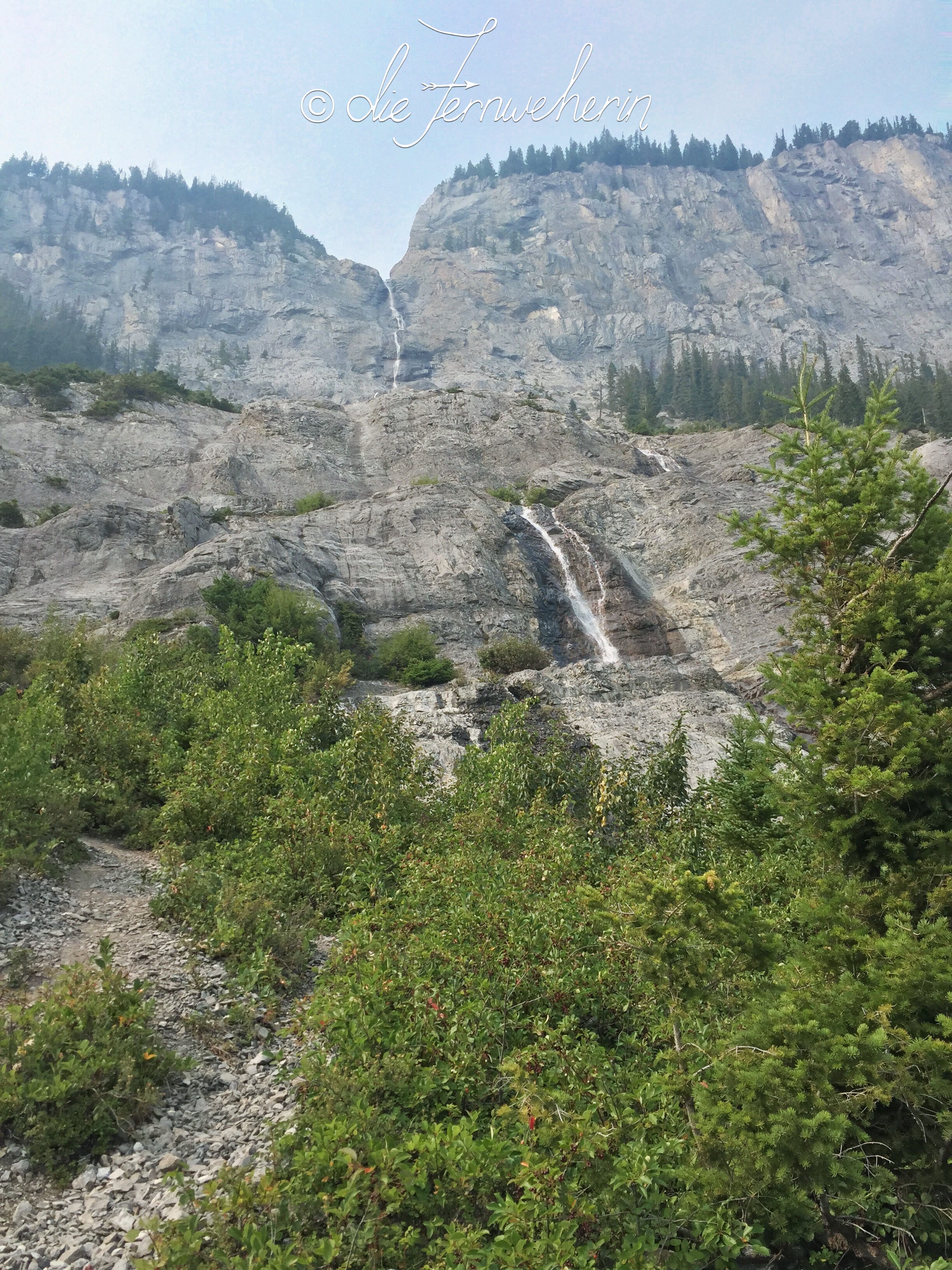
While his trail’s short length has earned it an “easy” rating from most other guides, I personally feel that it is much more difficult than advertised. Because it’s so short it’s also quite steep, and the path is littered with scree that makes the going even tougher. That said, the views are fantastic, made even better by completing an optional scramble along the chute of the waterfall itself. We hiked this on a fairly smokey day, and we could still see the entirety of the Cascade Ponds laid out before us, and almost all the way to Banff Townsite. If you’re going to tackle this trail, I highly recommend hiking poles year-round.
C-level cirque trail
<< contents // < moderate trails
trail stats
type |
out & back | rating |
7.5/10 |
length |
~8km ✲ | time |
~2.5h ✲ |
elevation |
~540m ✲ | difficulty |
hard ✲ |
trailhead |
Upper Bankhead parking lot (on the west link of Lake Minnewanka Scenic Dr) | ||
use |
hiking/trail-running (year-round), snowshoeing (winter) | ||
map
description
This is a super-popular, classic Banff hike. It’s a steady uphill climb that winds through dense forest and past remnants of the old Bankhead coal mine & town. Once you pass the tree line, you’ll be rewarded for your efforts with wonderful views of Rundle Mountain. If you’re up for a challenge, try scrambling up to the peak of the cirque for an amazing panoramic vista featuring Lake Minnewanka (~1.5km / ~210m 𝚫 / ~1h). If you’re hiking this trail in the winter, crampons are a must, and poles are highly recommended due to the slope.
Please note: There is no parking at the trailhead in the winter. The west leg of the Lake Minnewanka Scenic Drive loop road is closed to vehicle traffic from November to May each year. Access during this time by parking at the Lake Minnewanka parking lot and walking or biking along the road to the trailhead. This additional distance is not included in the trail length above.
<< contents
Difficult Trails
- Lower stoney trail
- Brewster creek trail
- Citadel pass trail
- Healy pass trail
- Cascade amphitheatre trail
- Aylmer lookout trail
- Cascade summit trail
- Pharaoh peak trail
Lower stoney trail
trail stats
type |
out & back ✲ | rating |
2/10 |
length |
~8.5km | time |
~3h |
elevation |
~480m | difficulty |
hard |
trailhead |
Mount Norquay parking lot (at the end of Mt Norquay Rd) | ||
use |
biking/hiking/trail-running (spring/summer/fall) | ||
map
description
This trail begins (funnily enough) just above the Upper Stoney Lookout Trail, cuts through the dense forest along the side of Stoney Mountain on a fairly straight shot downhill, and spits you out from the trees onto the shoulder of the Trans-Canada Highway (Hwy 1). There’s not much in the way of the panoramic mountain views that Banff is so famous for, so between that and the gruelling climb back up, it is rarely used by hikers. It is, however, a favourite for mountain bikers, so if you do choose to hike it, stay alert as you go. The point-to-point version of this trail is much more appealing (~4.3km / ~260m ↓ / ~1h), but relies on being able to arrange a vehicle shuttle at the bottom.
Brewster creek trail
<< contents // < difficult trails
trail stats
type |
out & back | rating |
3/10 |
length |
~19.5km | time |
~6.5h |
elevation |
~700m | difficulty |
hard |
trailhead |
Healy/Brewster parking lot (on Sunshine Rd) | ||
use |
biking/hiking/trail-running (year-round), horseback-riding (summer), snowshoeing/XC-skiing (winter) | ||
map
description
This trail gets its difficulty rating primarily from its sheer length, rather from any technical aspects or inordinate elevation gains. In fact, it’s a very gradual climb that would be quite enjoyable if it had more to offer in the way of views. The daytrip version of this trail ends at Sundance Lodge (services for registered guests only), and from there the trail continues several kilometres on to a backcountry campground. This trail experiences frequent horse traffic and is often extremely muddy, especially in the spring or after a heavy rain. Bug spray is a must from late spring to early fall.
Citadel pass trail
<< contents // < difficult trails
trail stats
type |
out & back | rating |
9/10 |
length |
~16km | time |
~5h |
elevation |
~655m | difficulty |
hard |
trailhead |
extension to the Sunshine Meadows Trail | ||
use |
hiking/trail-running (summer/fall) | ||
map
description
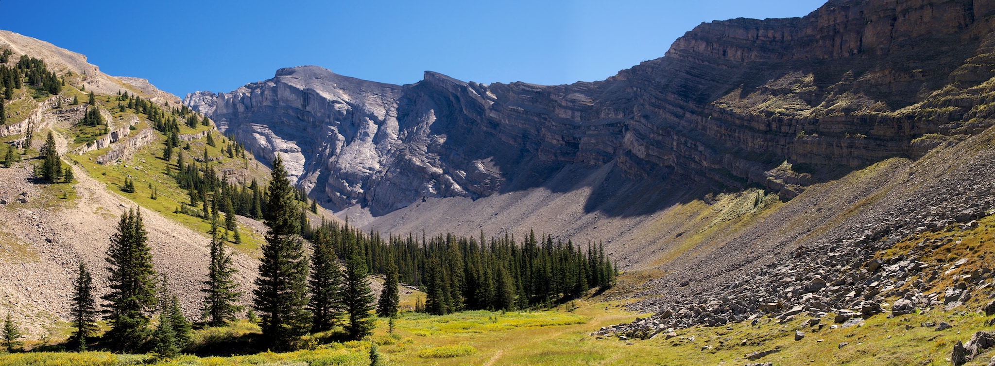
Straddling the continental divide—the border between the provinces of Alberta and British Columbia—this trail makes its way across a variety of terrain, from verdant forests to wide-open meadows to craggy mountain faces. It’s especially fantastic in late July to early August when the alpine wildflowers are in peak bloom, making you feel like you’re on the set of The Sound of Music. Due to its length, it’s fairly lightly-trafficked, so if the crowds at Sunshine Meadows are getting to be a bit much, this is a great option. If you’re feeling like the full length of this trail is too much, you can hike just to Howard Douglas Lake & back (~9.5km / ~385m 𝚫 / ~3h); conversely, if you’ve gone the full length and are looking for more, you can scramble to the top of Citadel Peak for beautiful bird’s-eye views of Citadel Lake (~1.5km / ~235m / ~1h).
Please note: This trail is an extension. In order to access this trail, you will have to travel partway along the Sunshine Meadows Trail first (~3.5km / ~155m 𝚫 / ~1h roundtrip); this is not included in the trail length above. Also, the “hard” rating for this route relies on using the Sunshine Gondola to access the starting point. If the ticket price ($74 roundtrip per adult) is too steep, or if you really want to bring your dog with you (pets are not permitted on the gondola), access to this trail is still possible by hiking up the Banff Ave ski trail (~12km / ~700m 𝚫 / ~4h), plus the entirety of the Rock Isle Road portion of Sunshine Meadows Trail (~3km / ~130m 𝚫 / ~1h). However, the additional distance and elevation gain incurred would put this trail firmly in the challenging category.
Healy pass trail
<< contents // < difficult trails
trail stats
type |
out & back | rating |
9/10 |
length |
~18.5km | time |
~7h |
elevation |
~890m | difficulty |
hard |
trailhead |
Sunshine Village parking lot (at the end of Sunshine Rd) | ||
use |
hiking/trail-running (summer/fall) | ||
map
description
This trail follows Healy Creek to its source high in the mountains, passing through forests of larches along the way, and ending at a beautiful meadow above the treeline. It’s a lovely route throughout the hiking season, but it’s a must-do trail near the end of July (when the pass is alive with wildflowers) and/or in mid to late September (when the larch trees turn a brilliant golden yellow). Several backcountry routes exist past the end of this hike, which you’re welcome to explore if your feet and legs are up to it. Popular options include Pharaoh Peak Trail or Eohippus Lake Trail as extensions, or forming a loop with Sunshine Meadows Trail (~31km / ~1400m / ~10h in total).
Cascade amphitheatre trail
<< contents // < difficult trails
trail stats
type |
out & back | rating |
7/10 |
length |
~14km | time |
~5.5h |
elevation |
~900m | difficulty |
challenging |
trailhead |
Mount Norquay parking lot (at the end of Mt Norquay Rd) | ||
use |
hiking/trail-running (spring/summer/fall), snowshoeing (winter) | ||
map
description
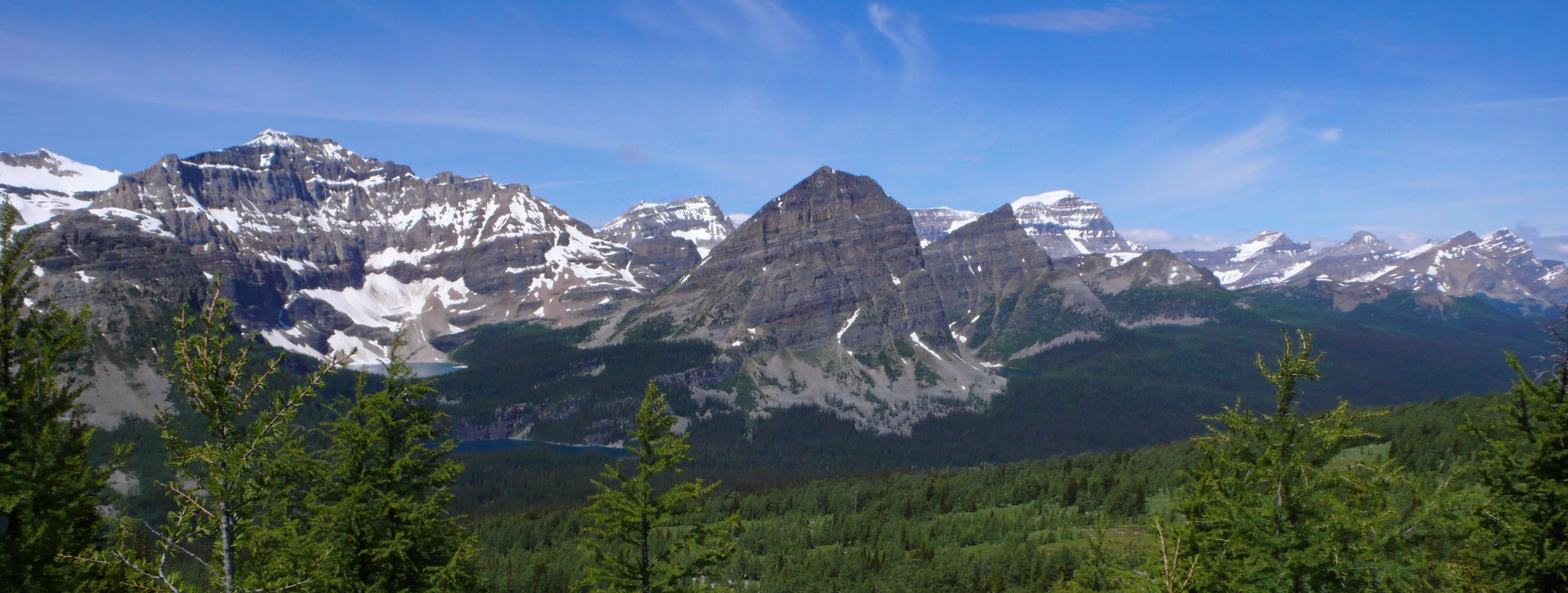
From the parking lot, begin by hiking along a service road that passes behind the chairlifts; when you reach the Mystic lift, take the trail that branches off the road, leading you into a dense forest. After a series of seemingly never-ending switchbacks, you’ll emerge from the trees into a huge clearing surrounded by high rock walls—a natural amphitheatre, formed by glaciers. In late July to early August, the meadow is full of alpine wildflowers in full bloom, a truly spectacular sight to behold. From the amphitheatre itself, you can hike a little further towards a rock field for some great views, as well as a chance to spot pikas and marmots scampering about. If you’re an advanced hiker with a good amount of experience in scrambling, continue on to Cascade Summit Trail for truly amazing panoramic views.
Aylmer lookout trail
<< contents // < difficult trails
trail stats
type |
out & back | rating |
9/10 |
length |
~7.5km ✲ | time |
~3.5h ✲ |
elevation |
~595m ✲ | difficulty |
challenging |
trailhead |
extension to the Lake Minnewanka Lakeside Trail | ||
use |
hiking (year-round) | ||
map
description
Anytime you see the words “decommissioned fire lookout” when you’re reading up about a hike, you know that it’s going to feature drop-dead gorgeous vistas. And this trail is no exception; it has some of the best views of teal-blue Lake Minnewanka that you can get without scrambling up a mountain. If you’d like, you can continue onto Aylmer Pass (an additional ~6.5km / ~440m 𝚫 / ~3h) for some more views of the lake from above the treeline, as well as meadows full of alpine wildflowers. Make sure to take plenty of water, as well as a packed lunch of some kind, as tackling this trail means a full day of strenuous hiking. Also, bear in mind that this trail is subject to seasonal restrictions from mid-July to mid-September; these measures are put in place by Parks Canada to keep both people and wildlife safe.
Please note: This trail is an extension. In order to access this trail, you will have to complete both the Stewart Canyon Trail and the Lake Minnewanka Lakeside Trail first; this is not included in the trail length above.
Cascade mountain
summit trail
<< contents // < difficult trails
trail stats
type |
out & back | rating |
10/10 |
length |
~7km | time |
~4h |
elevation |
~870m | difficulty |
expert |
trailhead |
extension to the Cascade Amphitheatre Trail | ||
use |
hiking (summer) | ||
map
description
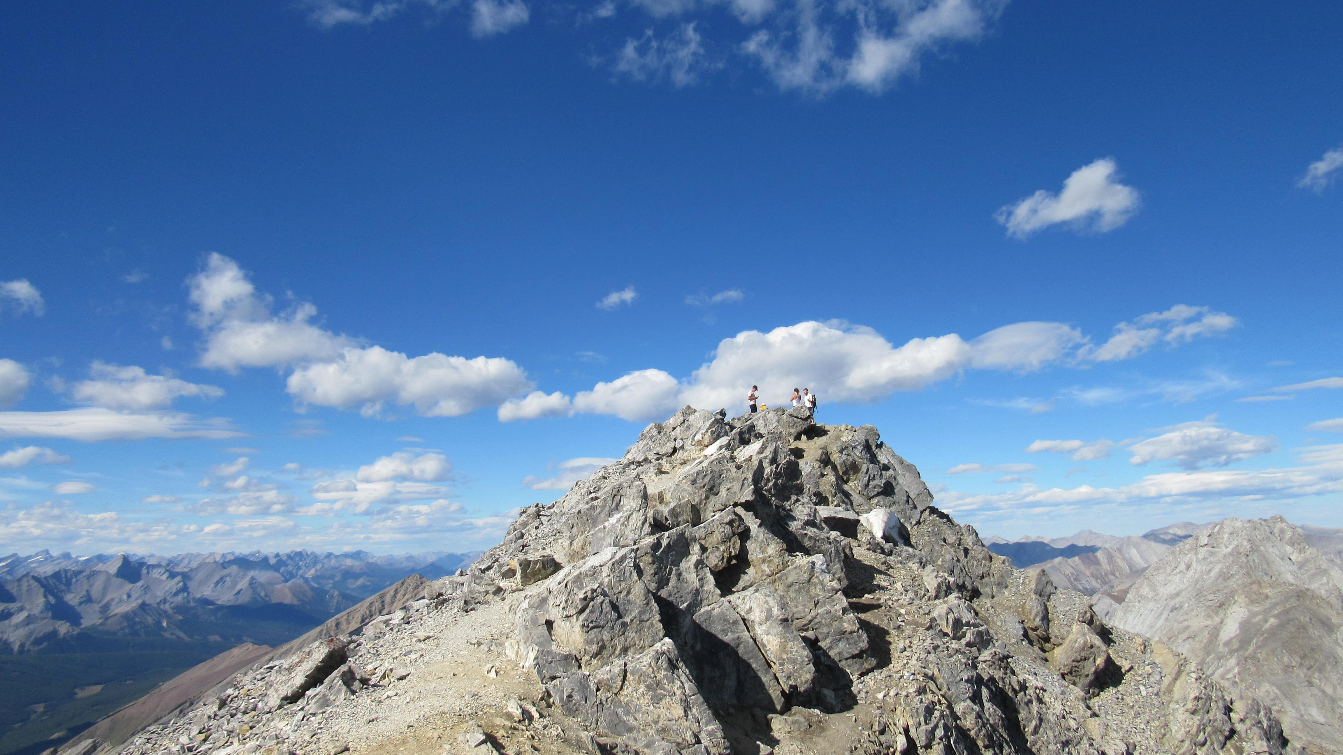
While the effort required to reach the top of one of Banff’s most iconic mountains is certainly intense, the payoff is more than worth what you’ll pay in sweat. The sweeping, unobstructed views are simply sublime. From the craggy summit of Cascade Mountain, take in the town of Banff nestled in the Bow Valley, brilliant blue Lake Minnewanka, and the surrounding peaks of Mount Norquay, Mount Rundle, and Sulphur Mountain. If this hike is on your list, be sure to check out the Parks Canada guide to completing it.
Please note: This trail is an extension. In order to access this trail, you will have to complete the Cascade Amphitheatre Trail first; this is not included in the trail length above.
Pharaoh peak trail
<< contents // < difficult trails
trail stats
type |
out & back | rating |
10/10 |
length |
~14.5km | time |
~7h |
elevation |
~1245m | difficulty |
expert |
trailhead |
extension of the Healy Pass Trail | ||
use |
hiking (summer/fall) | ||
map
description
This trail is seldom trafficked, and when it is, it’s rarely done as a day hike. The level of fitness & scrambling skills needed to complete this trail, particularly in one day, are exceedingly high. Even when done on its own as a backcountry hike, the climb up to the top of Pharaoh Mountain is gruelling; when combined with the length and elevation gain of Healy Pass Trail, it’s downright brutal. That said, if you’re up for an extreme challenge, then the views you’ll experience—ranging from magnificent craggy mountain peaks, to a dazzling panorama of brilliant blue glacial lakes—are truly outstanding. If clambering up Pharaoh Peak itself is out of your wheelhouse, you can choose to cut this trail “short” at Egypt Lake; you won’t see the same amazing bird’s-eye-style vistas, but you’ll still be able to admire the mountain itself, along with one of its several beautiful lakes, and your feet & legs will thank you profusely (~7.5km / ~490m 𝚫 / ~3h).
Please note: This trail is an extension. In order to access this trail, you will have to complete the Healy Pass Trail first; this is not included in the trail length above.
<< contents
What’s your favourite hike in Banff? Are any of these trails new to you?
Please leave a comment to share your feedback on this post, and/or your own tips & experiences.
Thank you so much for reading!
Happy travels,
